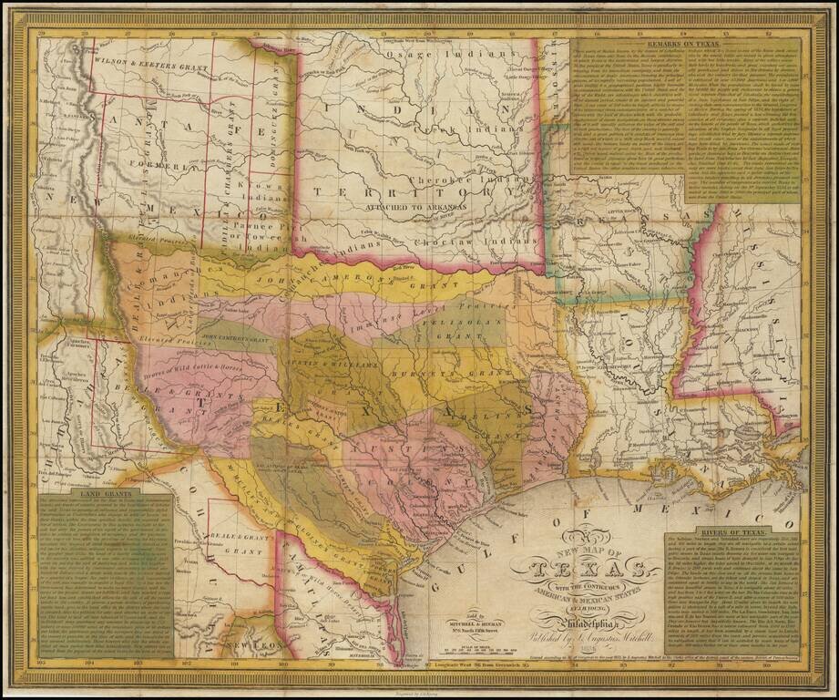
A fine example of Young & Mitchell's map, one of the truly great early maps of Texas, published in 1836, the year that Texas became the independent 'Lone Star Republic'. Young & Mitchell's A New Map of Texas, especially in the present first...
An Important Early Map of The Republic of Texas. Young & Mitchell's A New Map of Texas is one of the great monuments of Texan cartography. This is an essential piece for any serious collection of Texana. This is Streeter's 4th state (of 8, 1178D)...
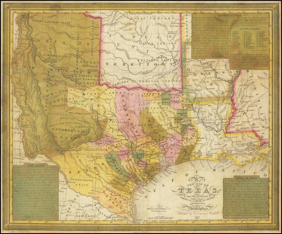
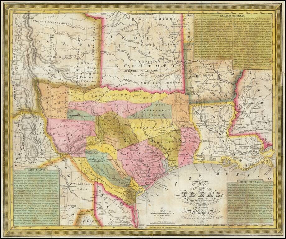
The Final Edition of the Mitchell-Young Map of Texas. One of Only Two or Three Known Examples. Hand-colored engraved antique map of Texas as a republic, by S. Augustus Mitchell and J.H. Young. This is the last edition of the map, from 1845, and this...
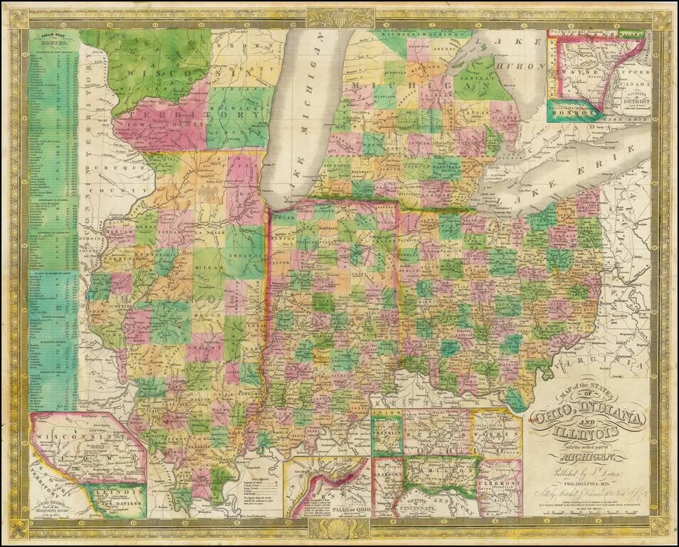
Excellent antique hand-colored engraved map of the eastern Midwest, covering Michigan, Ohio, Indiana, Illinois, and the southern half of Wisconsin. This is a rare later state of Finley's map of eastern Midwest, first issued in 1825, here in the 1835...
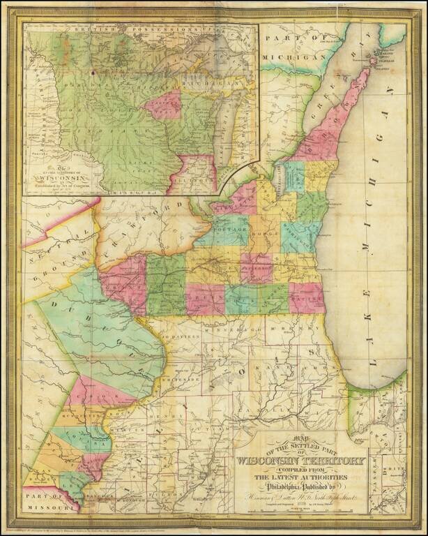
A Foundational Wisconsin Map. This is an important early map of Wisconsin, published only two years after the territory was incorporated. The map centers on the areas now part of southwestern Wisconsin and eastern Iowa. In this area, the most...