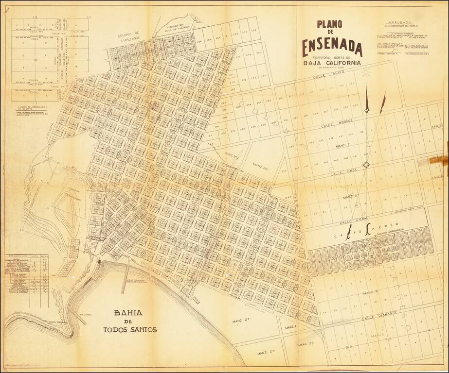
A mid-century map of Ensenada, Baja California del Norte. It shows the port of Todos Santos, the layout of the city and its neighborhoods, and plots of land not yet developed. The margins contain notes and tables showing how new plots should be labeled...