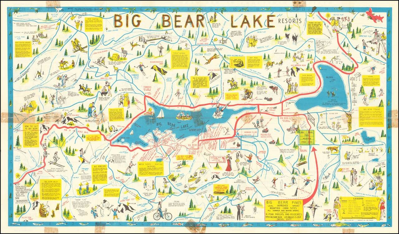
Rare Big Bear Lake Pictorial map, published by the Recreational Publishing Company. The main map shows the area around Big Bear Lake, with emphasis on recreational activities, both winter and summer, including Moonridge Ski Run Snow Valley...
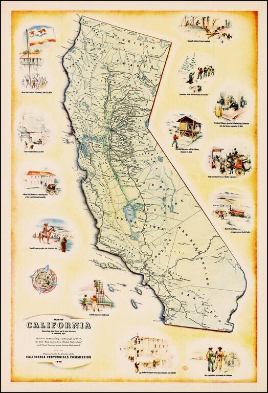
Decorative map of California, prepared under the direction of the California Centennial Commission to celebrate 100 years of California statehood. The map shows California as it was in 1848 and includes illustrations of the Bear Flag Revolt, San...
![[California] Honor Roll Foresters of America May 1, 1947 to May 1, 1948](/map/small/63016.jpg)
Previously unrecorded map of California, promoting the growth of the Foresters of America within California from May 1947 to May 1948. Includes the following information: 27 Courts Initiated 582 Re-instated 5 Net Gain 12 Courts Total - 59...
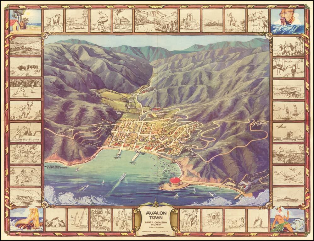
Pictorial Map of Avalon, During the Catalina Golden Age Decorative birdseye view of the town of Avalon on Santa Catalina Island, off the coast of Southern California. Includes a striking birdseye view of the town, Casino, harbor and vicinity, showing...
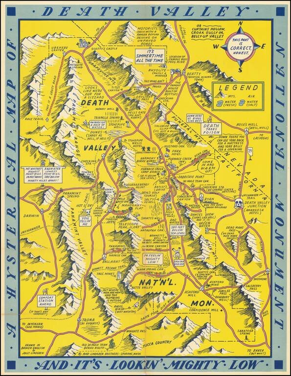
First edition of this humorous map of Death Valley. "Drawn In Broken English by Jolly Lindgren," this comic pictorial map is full of puns and comic vignettes related to Death Valley. The Lindgren Brothers issued a number of other silly whimsical maps...
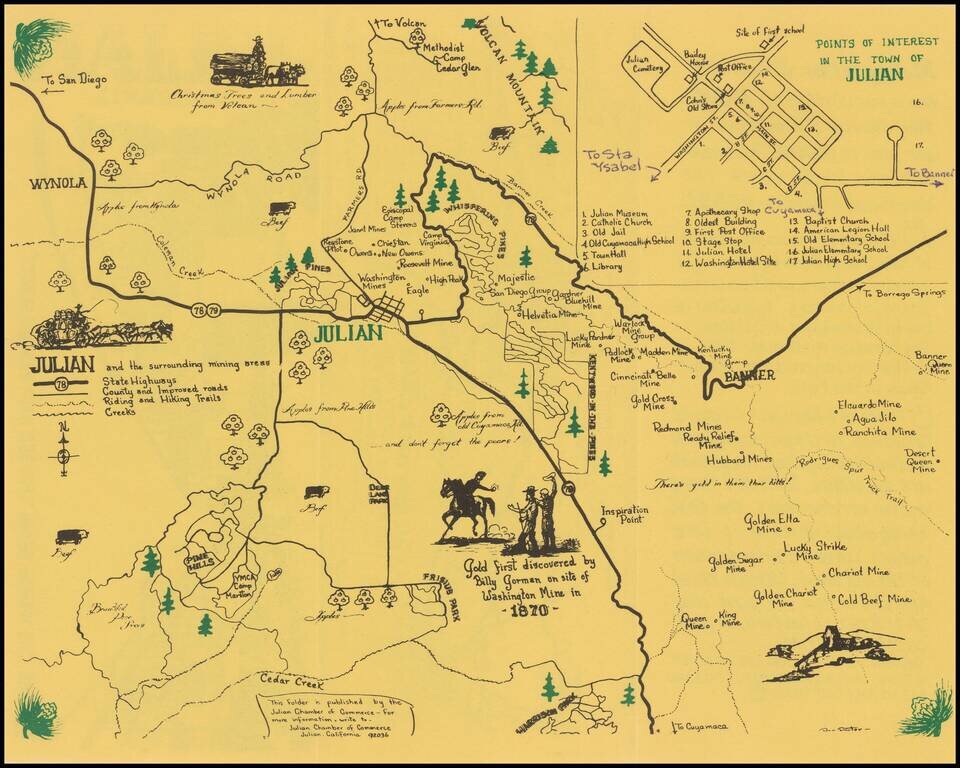
Julian -- Where Winds From The Sea and Desert Meet Rare pictorial map and promotional brochure for Julian, in San Diego County, published by the Julian Chamber of Commerce. The primary map shows the areas around Julian, stretching from Wynola and...
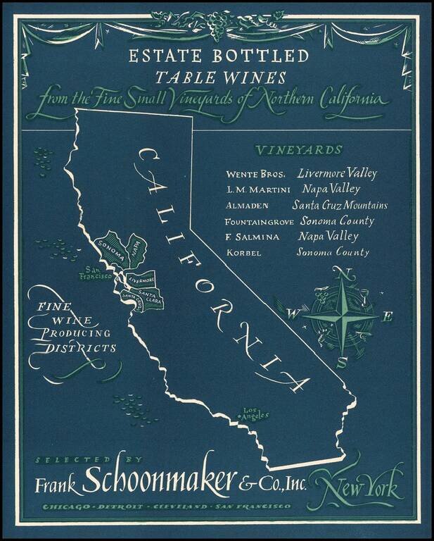
Rare advertising map promoting California wines. Frank Schoonmaker established himself in 1934 with his Complete Wine Book, and later, the classic Frank Schoonmaker's Encyclopedia of Wine. As a wine merchant he started "Frank Schoonmaker Selections"...
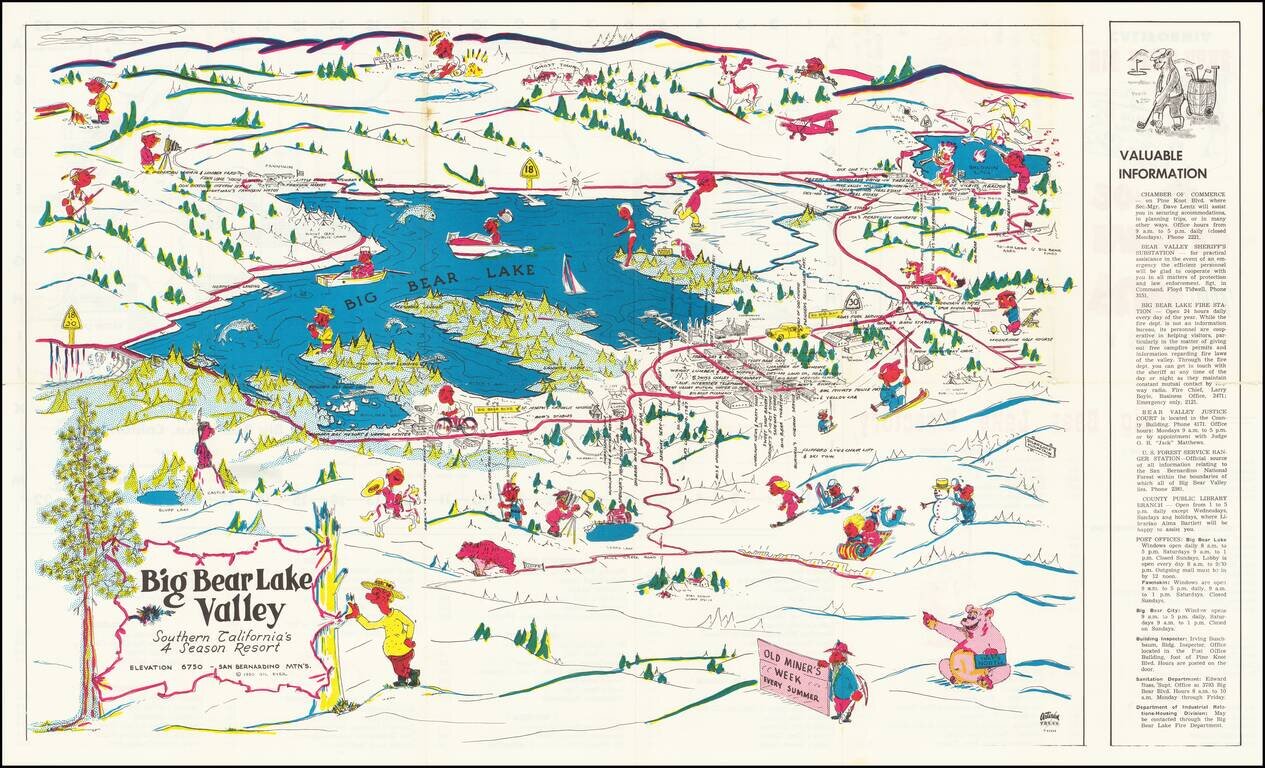
Rare Big Bear Lake pictorial tourist map, published by the Artisan Press in Azusa, California. The verso title is A Souvenir Fun and Street Map, with a price of 20 cents. The lake is filled with recreational and boating images, with the Clifford Lynn...
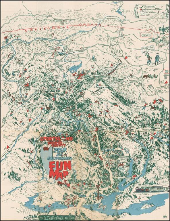
Whimsical pictorial map of Siskiyou County, California, published by the Weed, Shasta and Dunsmuir Chamber of Commerce.
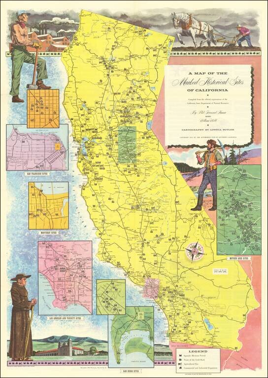
Interesting illustrated map of California, identifying each of the historical landmarks around the state, with inset maps of the area around San Diego, Los Angeles, San Francisco, Monterey and Gold Country. The landmarks are identified by whether they...
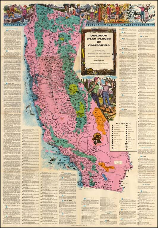
Large decorative map of California, identifying and location over 300 recreational areas around the state and including a series of decorative recreationally themed vignettes of fishing, camping, skiing, hunting and hiking, with additional vignettes...
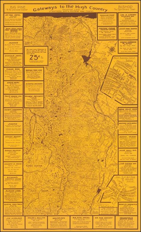
Rare promotional map tracking the John Muir Trail, Owens River and other interesting features in the region and ringed by local advertising. The present map is Emmet Hayden's first map, centered on the Bishop, Big Pine, Mammoth Lakes area, published...
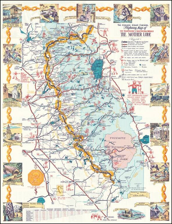
Decorative pictorial map of the Gold Regions of California. Includes 17 decorative vignettes and many annotations. Highly detailed. Includes Smokey The Bear. Difficult to date the map, as estimates of its age range from the 1950s to the early 1980s.
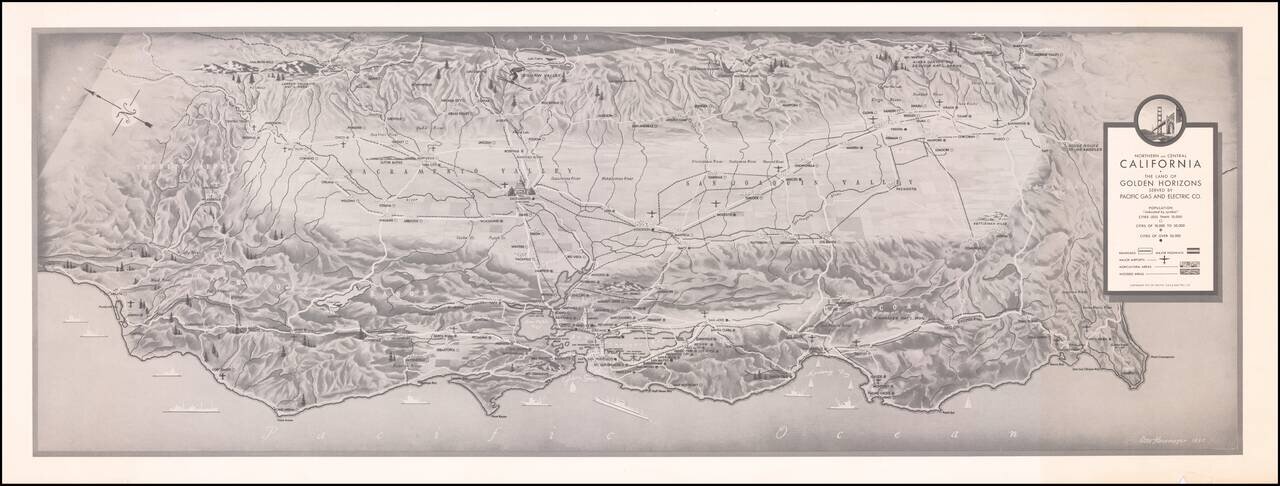
Finely executed map of Northern and Central California, prepared by Pacific Gas and Electric. The map locates cities (by size), Railroads, Major Highways, Major Airports, Agricultura Areas and Wooded Aresa. Rarity We locate a larger example in...
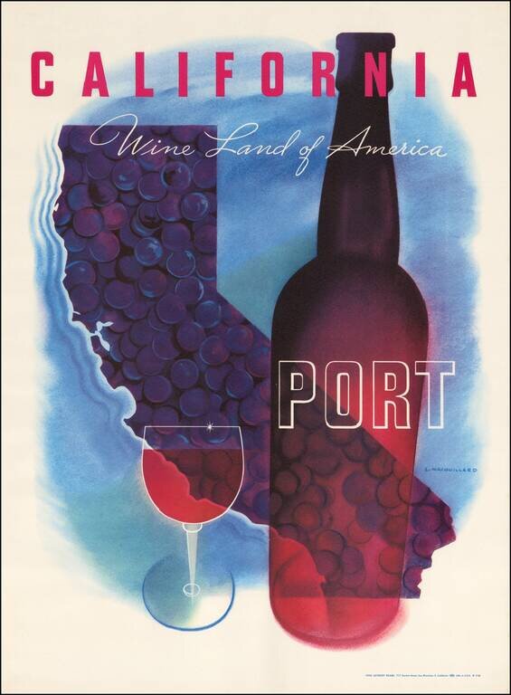
Striking map of California by Louis Macouillard in 1958. This is one of a series of Macouillard's images prepared for the California Wine Advisory Board in the 1950s, but to our knowledge, the only one to include a map image. Part of the great...
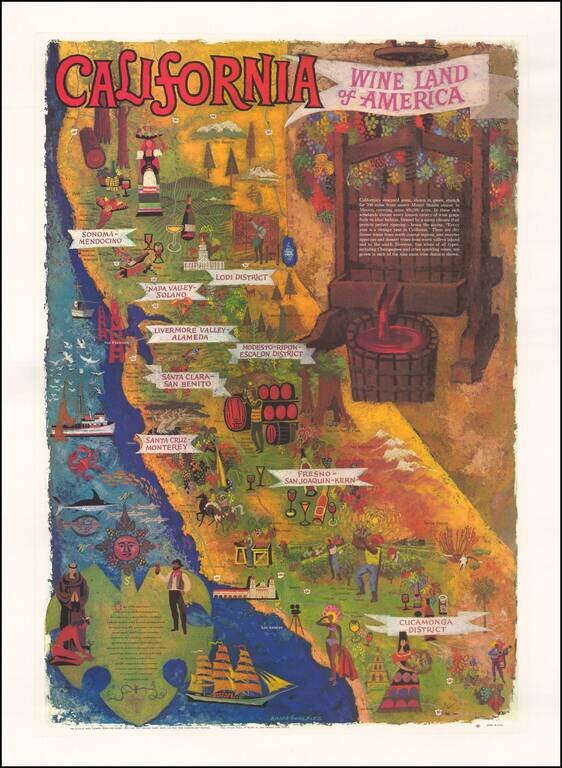
Striking map of California, prepared by the Wine Advisory Board to promote California wines. Includes a lively depiction of California's growing regions, with vignettes intended to illustrate the towns and characteristics of the various regions. The...