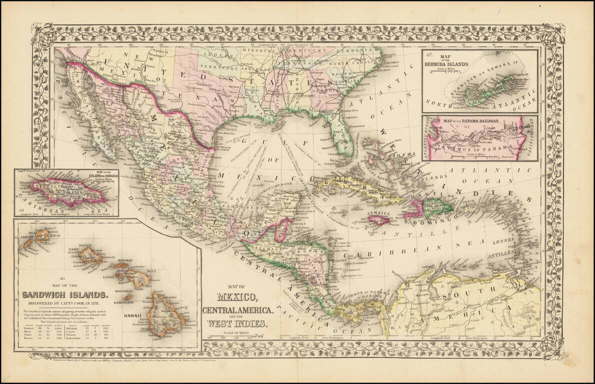
Rare and antique old maps of the North America
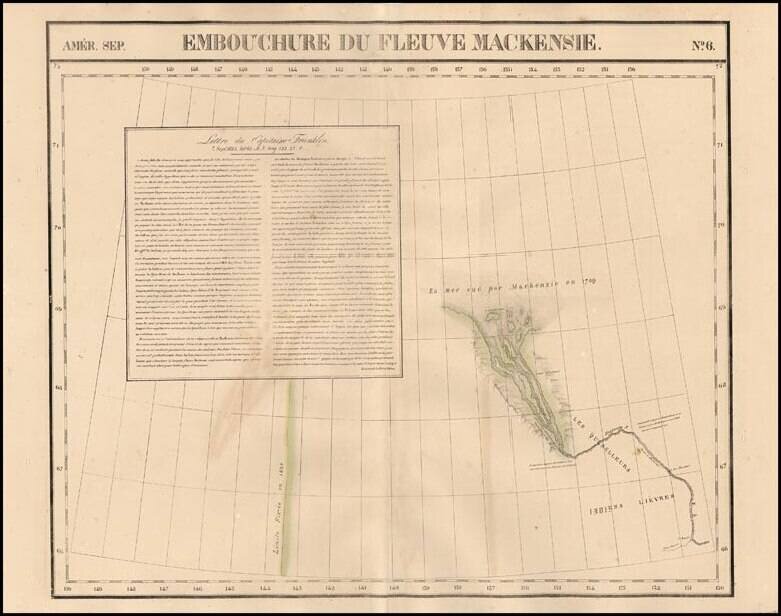
Highly detailed regional map, showing the mouth of the MacKenzie River and extending south to Petite Riviere and 1st Rapide. One of the earliest maps to focus on the region on such a large scale. The best large format map of the region during this...
![[MacKenzie River, Yukon Territory and Northwest Territory] Amer. Sep. No. 15. Grand Lac De L'Esclave](/map/small/19469.jpg)
Highly detailed map centered on the MacKenzie River and showing much of Yukon Territory and Northwest Territory. The map shows the region bounded the MacKenzie River, the Rocky Mountains and Grand Slave Lake. On the eastern portion of the map is a...
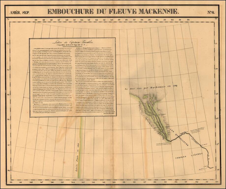
Regional map of part of the mouth of the MacKenzie River and the Arctic Sea. Shows towns, roads, rivers, mountains, and a host of other details. From Vandermaelen's remarkable 6 volume atlas, which if combined as globe gores forms an immense globe.
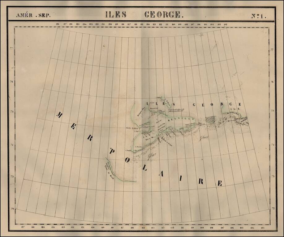
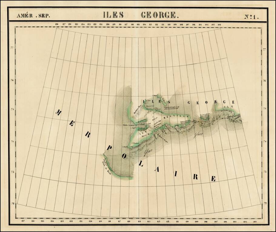
The Isles of George in the Arctic Sea. Shows towns, roads, rivers, mountains, and a host of other details. From Vandermaelen's remarkable 6 volume atlas, which if combined as globe gores forms an immense globe.
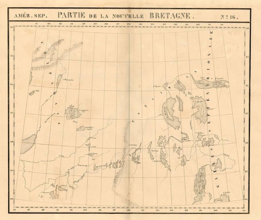
Large format map of the region the Esquimaux and Chippeway Lands of Canada. Highly detailed, with many rivers, lakes, place names, Indian Tribes, forts, etc. From Vandermaelen's remarkable 6 volume atlas, which if combined as globe gores forms an...
The Isles of George in the Arctic Sea. Shows towns, roads, rivers, mountains, and a host of other details. From Vandermaelen's remarkable 6 volume atlas, which if combined as globe gores forms an immense globe.
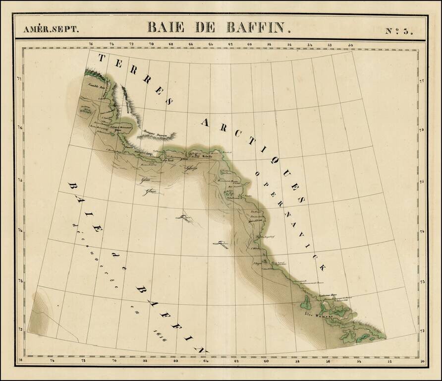
Large format map of the region bounded by Gamble Bay and Entrée de Baleine to Sandersons Hope and Iles Womens. Includes notes of David's voyage in 1587 and Baffin's voyage in 1616, Centered on Melville Baie. Shows the extensive ice flows in the...
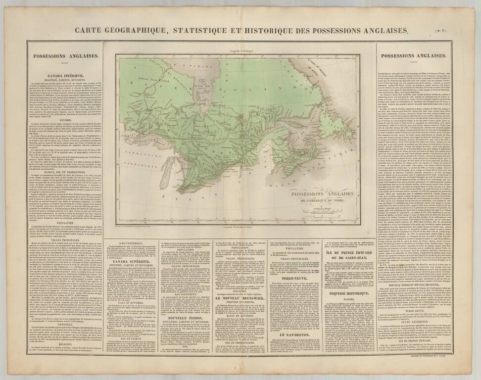
Scarce map of Canada, from JA. Buchon's fine American Atlas, published in Paris. Includes detailed descriptive text surrounding the map.
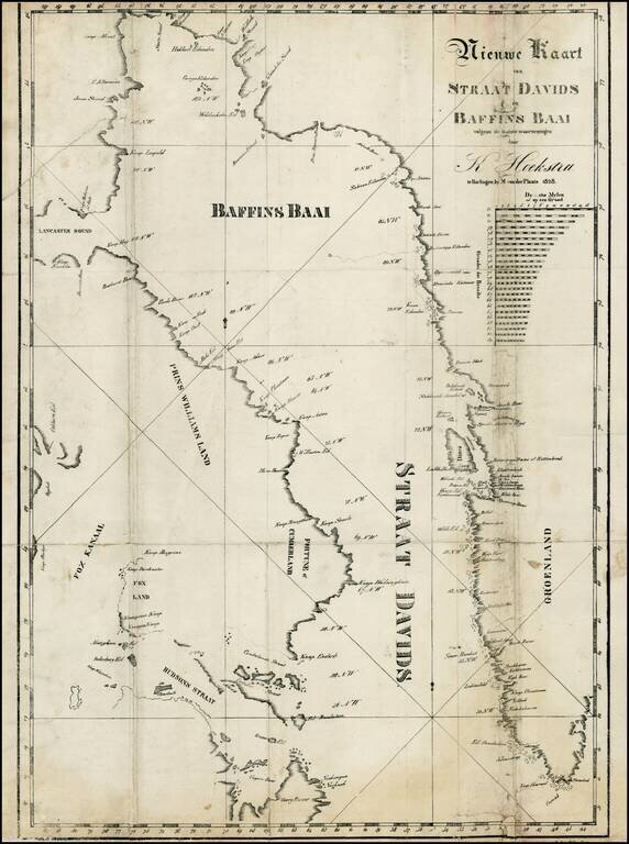
Rare map of the Baffin Bay and the David Straits, from Klaas Hoekstra's Dagverhaal van het verongelukken van het galjootschip Harlingen in Straat-Davids etc., in 1828. The last or nearly-last Dutch whaling voyage to the Arctic was an ill-fated venture...
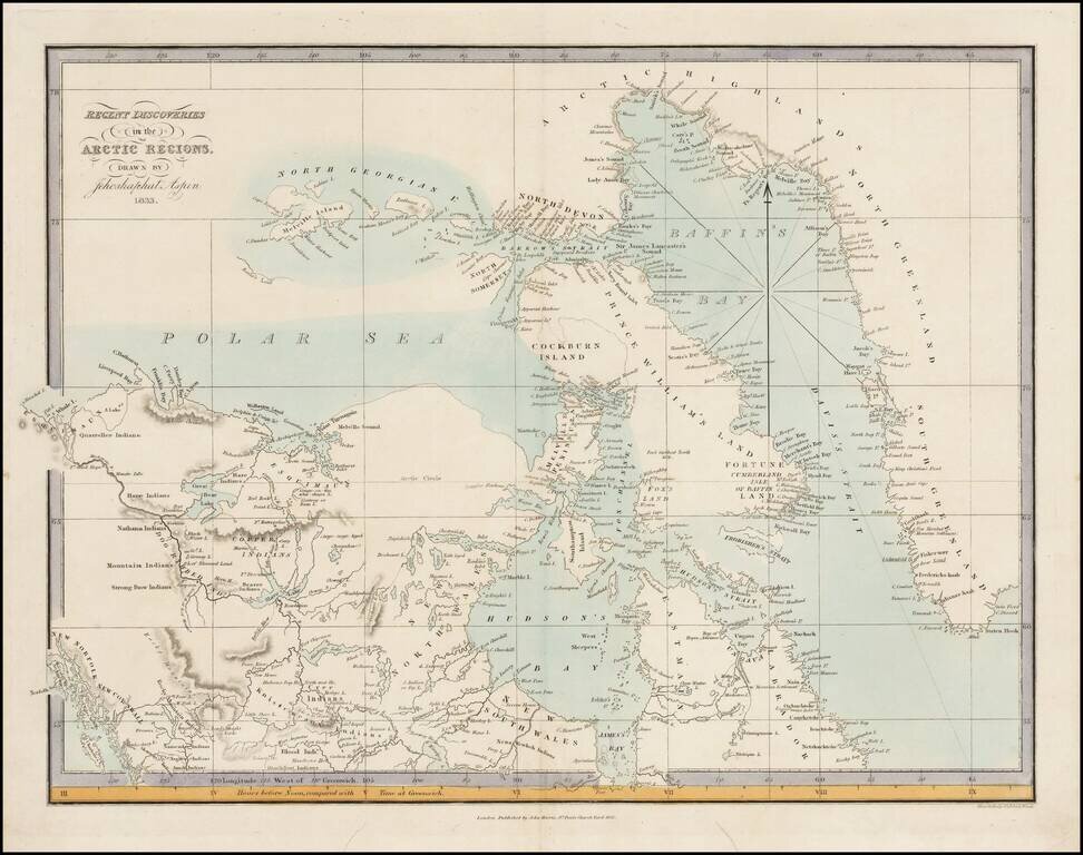
Very rare map of the Arctic Regions of North America, drawn by Jehoshaphat Aspin and published by John Harris in London. The map provides a marvelous snapshot of the known and partially explored regions of the Polar Seas, as of 1833. The map provides...
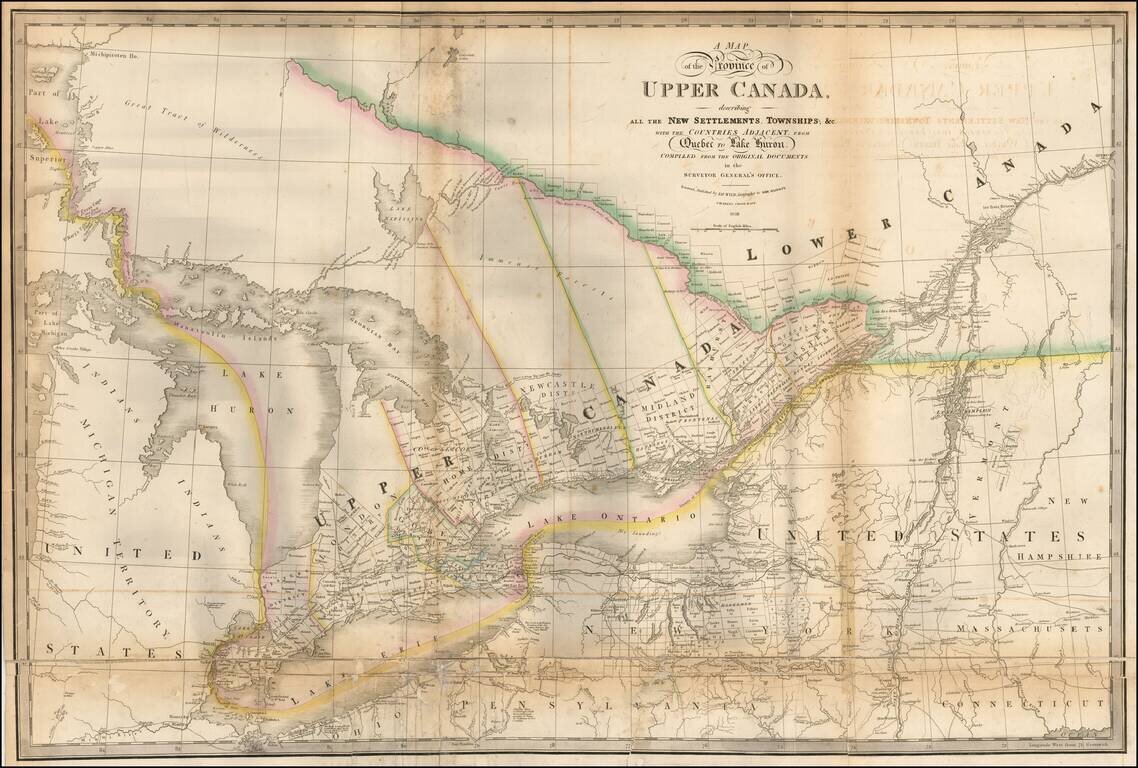
Highly detailed map of the Province of Upper Canada, originally published by David William Smyth and periodically revised over time. Fine map of Upper Canada, showing detailed information on the counties, districts, townships, transportation systems,...
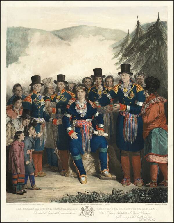
One of the Best Canadian Lithographs. Separately issued hand-colored lithograph of the newly-elected Chief of the Huron Tribe, by H.D. Thielcke. Lithographed by James Henry Lynch, Day & Haghe, Lithographers to the Queen. This superbly composed...
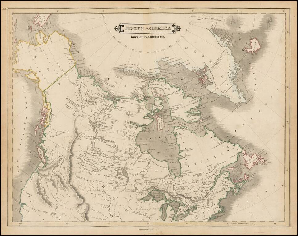
Nice example of Lizars map of Canada, Alaska and the Polar Regions. Excellent early map of Canada, Alaska and the Northwest part of America and contiguous regions covered by Lewis & Clark. The map provides a fine treatment of the search for the...
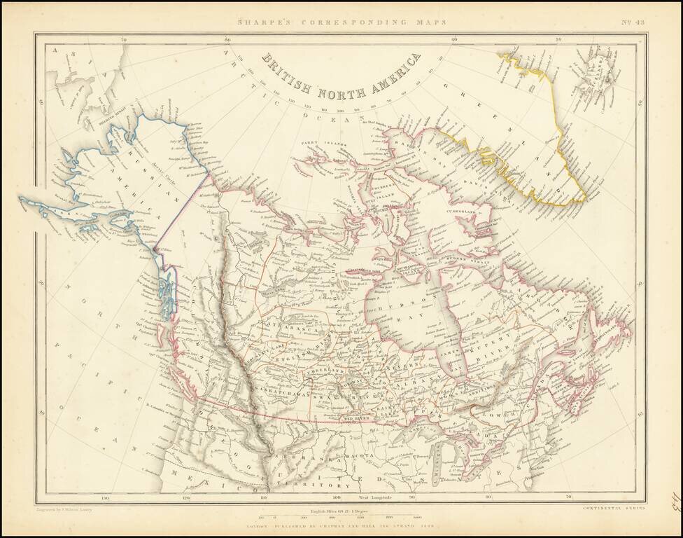
Scarce map of the British North America and Russian America (Alaska) published in London in 1848. The far western portion of Canada is labeled simply "Columbia and extends from the US to Russian America, dominated by a speculative "Cook River." A...
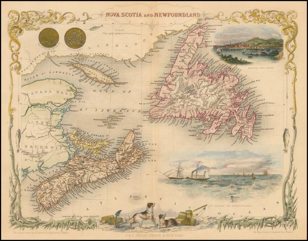
Striking full color example of this marvelous map of Nova Scotia, Newfoundland and the Gulf of St. Lawrence. Decorative Vignettes of Halifax, Cod Fishery Off Newfoundland, and several others. Engraved for R. Montgomery Martin's Illustrated Atlas....
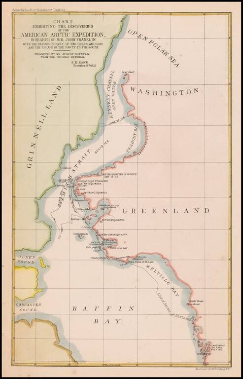
Map of the area of the Upper Part of Baffin Bay and the coasts of Greenland and Grinnell Land, illustrating the tracts of the Second Grinnell Expedition in 1854-1855. The Second Grinnell expedition of 1853–1855 was an American effort, financed by...