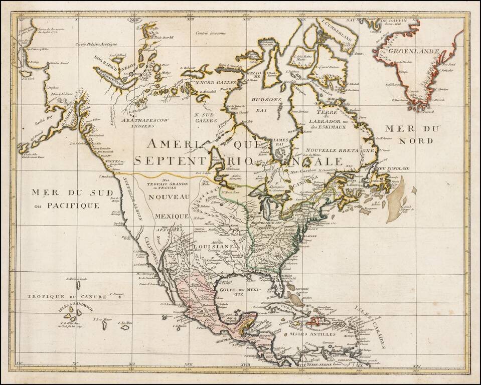
Very rare map of North America, published shortly after Cook's discovery of the Sandwich Islands (shown). Includes a marvelous treatment of the Upper Northwest, Canada and Alaska, noting the Dogged Ribbed Indians in Canada and the 2 Volcanos in Alaska.
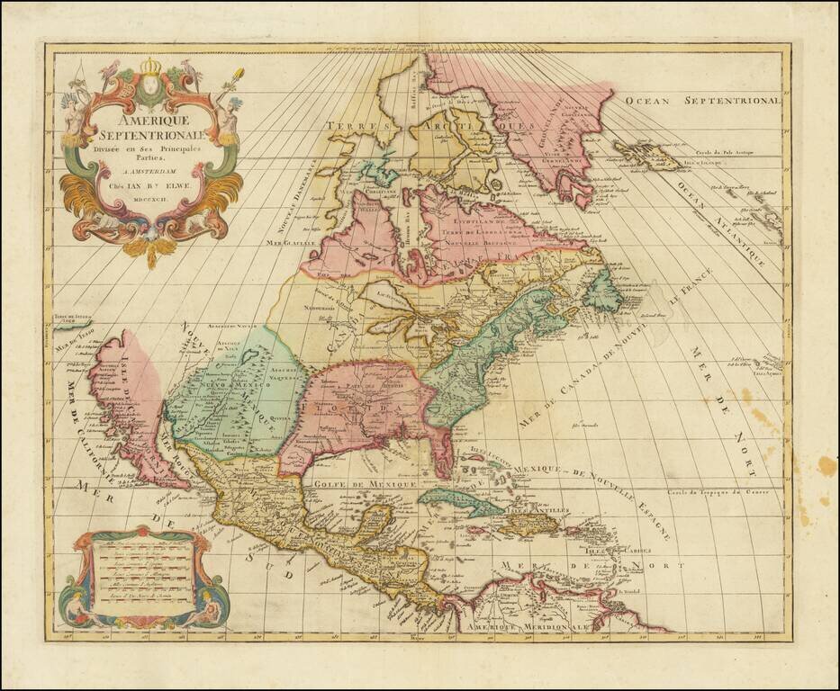
Interesting map of North America by Jan Elwe, printed in Amsterdam. The map is a scarce derivative of Sanson's 1656 and Jaillot's 1676 maps. California is now a peninsula. The Great Lakes are closed at the western ends, unlike the earlier versions of...
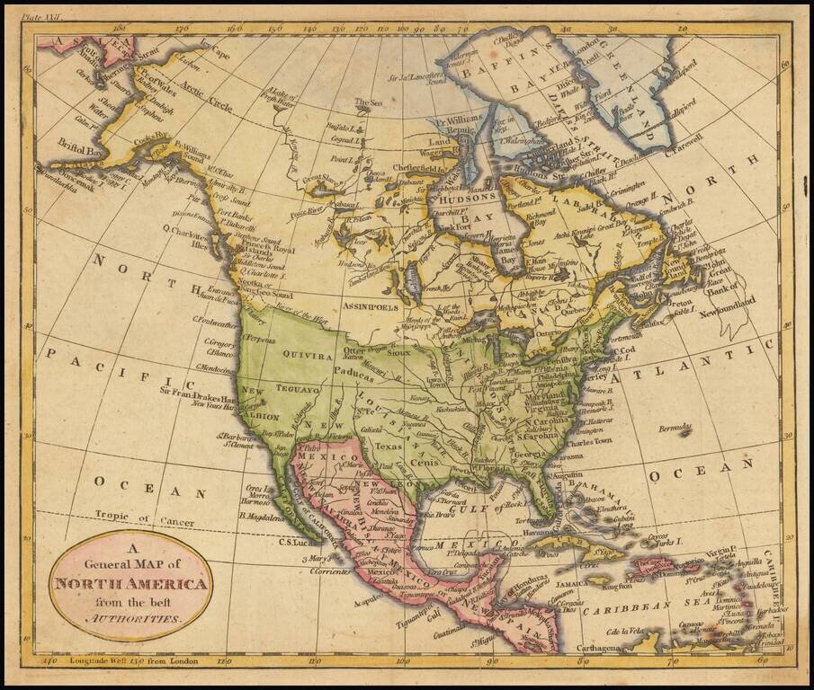
River of the West Interesting and detailed map of North America, showing the recent discoveries of Cook and other explorers on the west coast of North America, but pre-dating the circumnavigation of Vancouver Island. Quivira is shown, as is New...
![[Educational Map] North America](/map/small/68773.jpg)
Fascinating educational map of North America, bearing the engraver's signature of Neele, Strand (London). The map presents a remarkable look at North America at about the time Lewis & Clark set out on their expedition to find a practicable route...
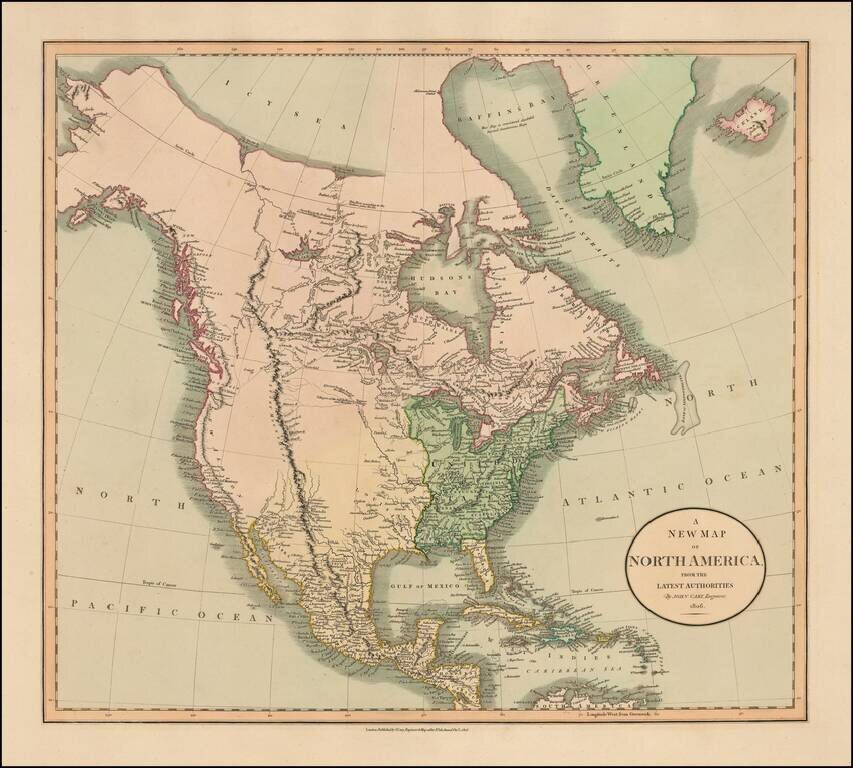
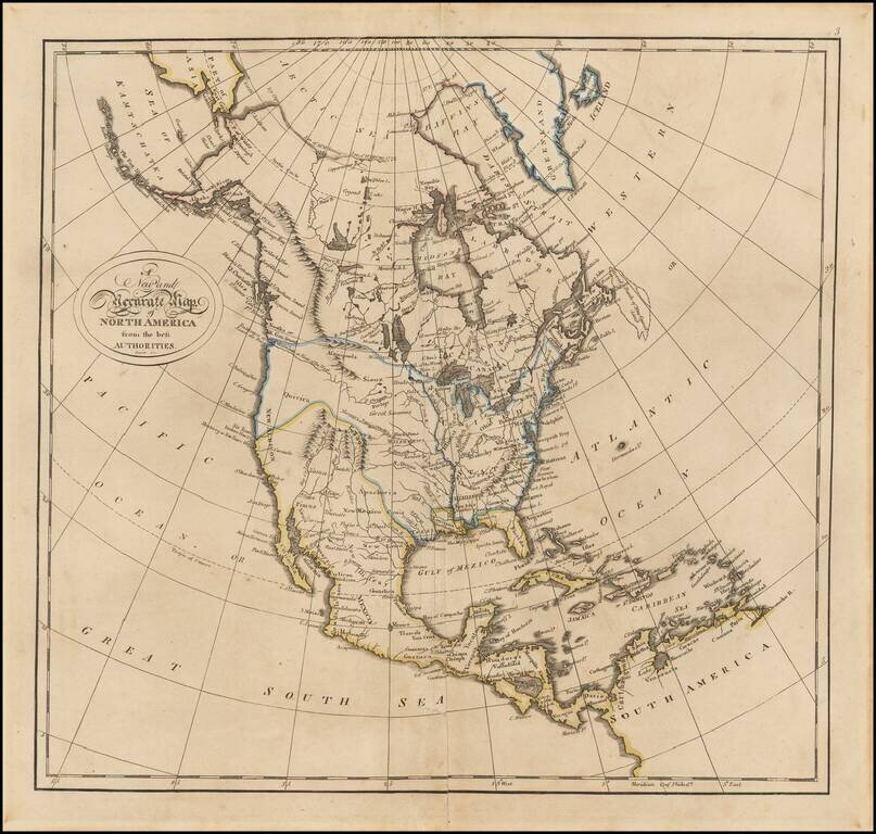
A Fascinating Pre-Louisiana Purchase Map of North America Scarce early map of North America, shortly before the Louisiana Purchase. An interesting time period, immediately preceding the reports of Alexander von Humboldt and Zebulon Pike, in the year...
Fascinating map of North America, reflecting the knowledge of the American West on the eve of the publication of the first official account and map of Lewis & Clark's expedition from the Missouri River to the mouth of the Columbia River. Excellent...
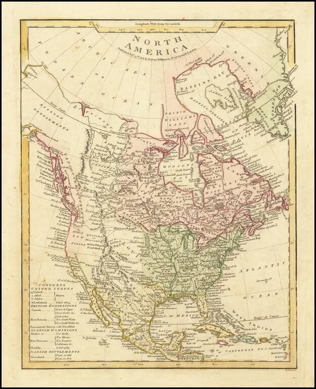
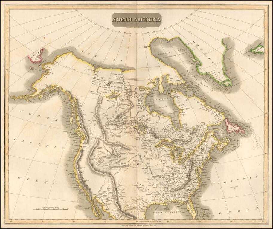
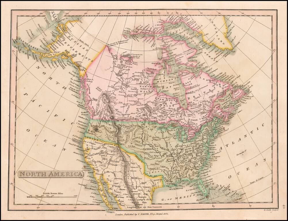
Terrific transitional map of North America, issued shortly before Lewis & Clark's seminal report map of the Northwest. Alaska is labeled Russian Settlements and has a marvelous conjectural coastline north and east of Cape Mulgrave. The Pacific...
Attractive map of North America, highlighting Louisiana Territory and the newly formed United States. The map includes a number of Western Indian Tribes, including the Assiniboels of the North, Assiniboels of the South, Monsonis, Sioux, Apaches,...
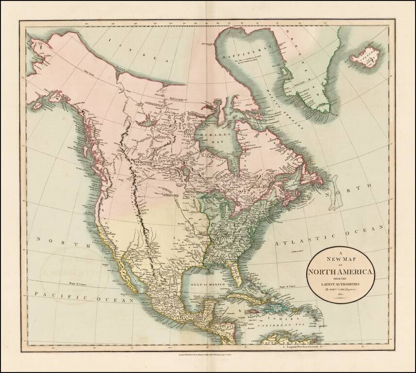
Fascinating map of North America, reflecting the knowledge of the American West on the eve of the publication of the first official account and map of Lewis & Clark's expedition from the Missouri River to the mouth of the Columbia River. Excellent...
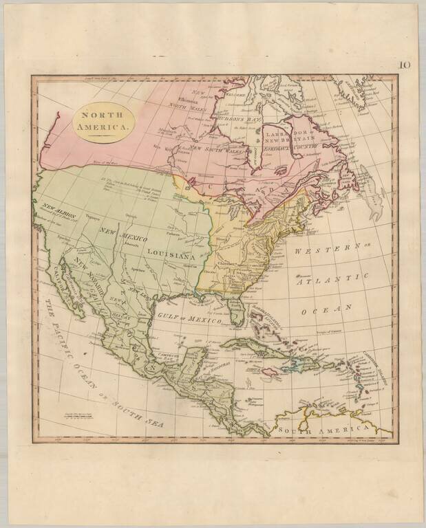
Columbia or River of the West! Fine example of Matthew Carey's map of North America, from his General Atlas. The map includes nice pre-Lewis & Clark information in the Transmississippi West. The "Columbia or River of the West" flows to the R....
A Fine Lewis & Clark era Map of North America Fine large format map of North America, reporting on some of the discoveries of Lewis & Clark, published by Thomson in 1814. West of the Rocky Mountains, the map shows pre-Lewis & Clark...
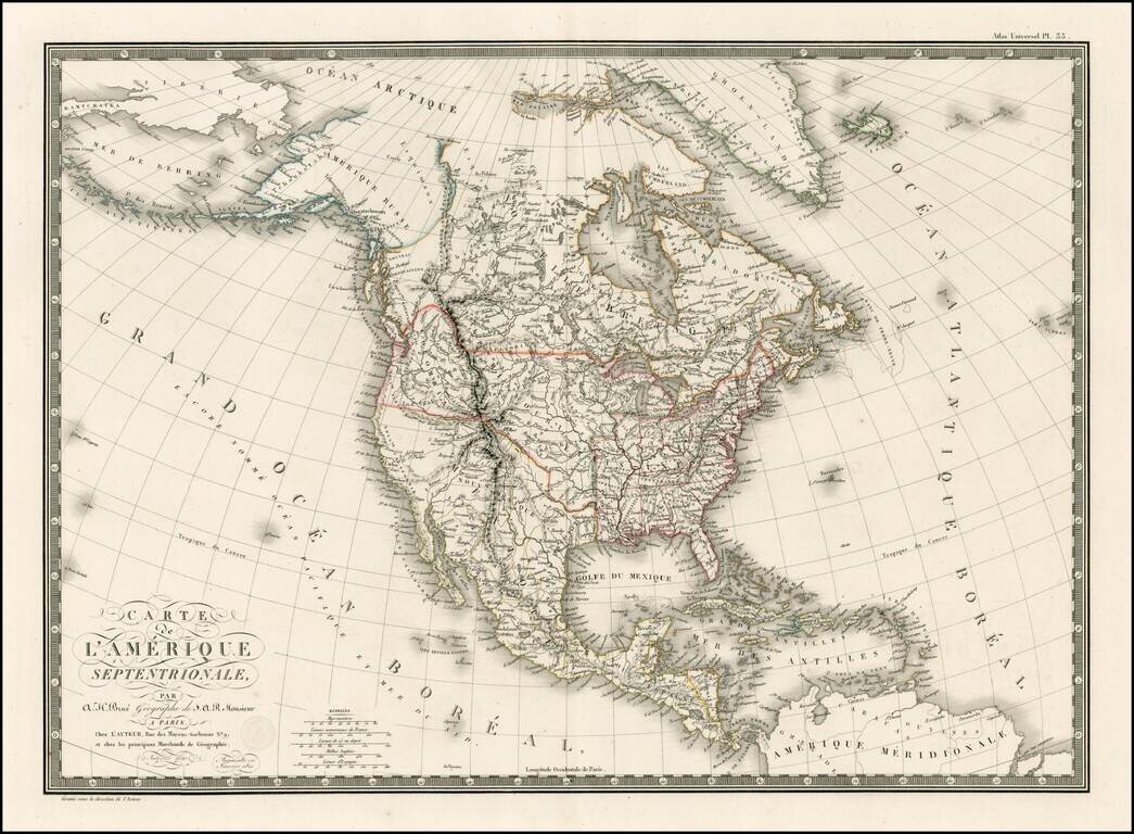
The British View of the Louisiana Purchase. Detailed map of North America, illustrating an Anglo-centric view of the land acquired by the United States in the Louisiana Purchase. The map illustrates two features which give away its political view....
Tremendous map of North America, exhibiting early details of Lewis & Clark's expedition and up to date information on the search for a northwest passage. There are two Salt Lakes, each linked by Rivers to the Pacific Ocean and each other. Lots or...
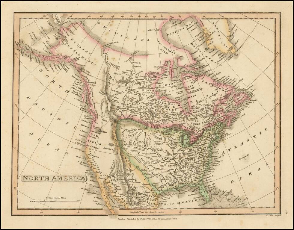
Post-Adams Onis Edition Detailed map of North America, illustrating the boundaries of North America, shortly after the Adams Onis Treaty established the boundaries between Mexico and the United States. The map illustrates features which give away its...
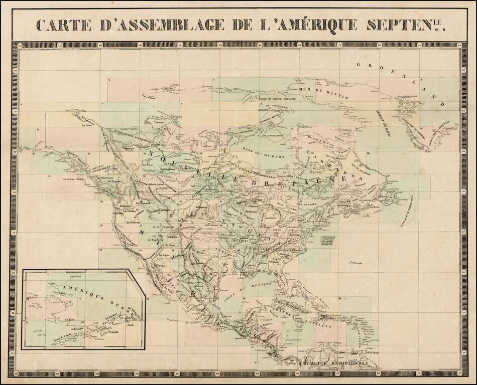
A nice example of Vandermaelen's Key Sheet to his map of North America, published in 76 Sheets, probably the grandest North American Wall map of the 19th Century. From Vandermaelen's remarkable 6 volume atlas, which if combined as globe gores forms an...
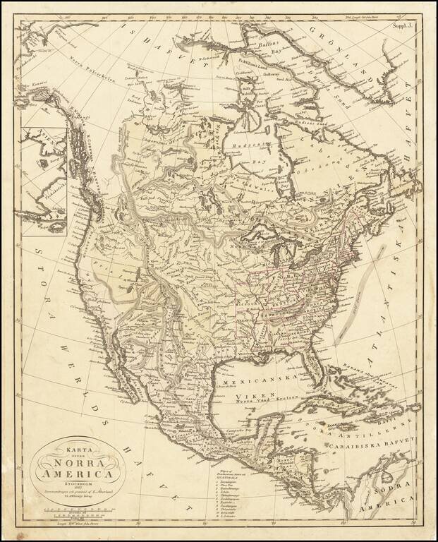
Rare Swedish map of North America, published by Akerland in Stockholm in 1827. The map is dominated by a massive Fria Indianer Lander (Free Indian Lands) in the Utah-Nevada area, with a fascinating depiction of the Trans-Mississippi West, including...