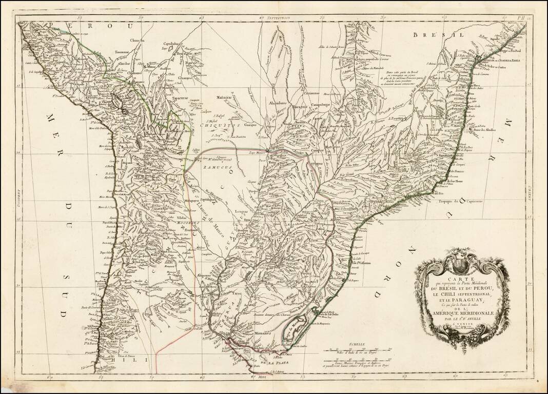
Finely engraved map of the central part of South America, from Santini's Venetian edition of d'Anville's map from "Atlas Universel," printed in 1776-84. The map includes much of Brazil, Peru, Chile and Paraguay.
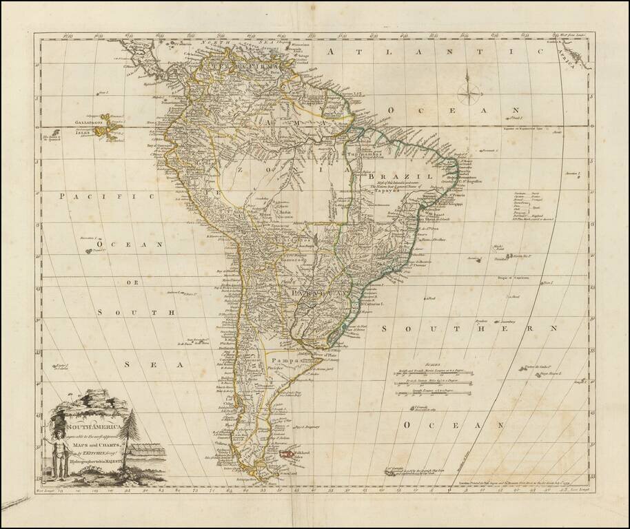
Detailed map of South America, drawn toward the end of Spain's colonial empire. Includes the Galapagos Islands and "Isles know to the Spaniards." A scarce early edition.
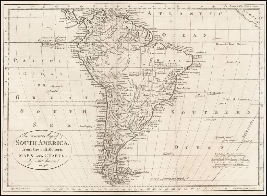
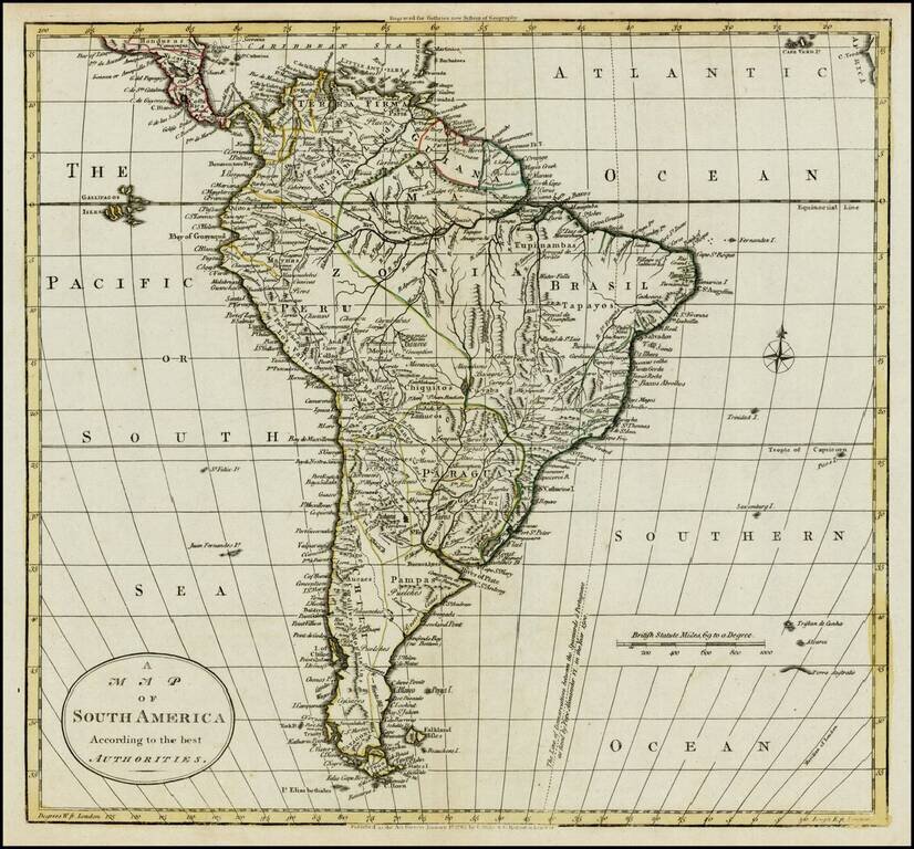
Detailed map of South America, on the eve of its Century of Revolution, which appeared in Middleton's Geography.
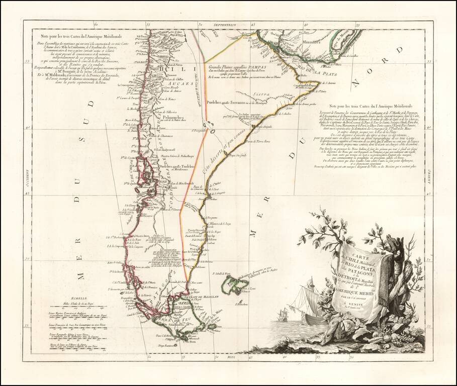
Finely engraved map of southern South America, focusing on Chile, Patagonia, Tierra del Fuego and the Strait of Magellan, from Santini's Venetian edition of d'Anville's map from "Atlas Universel" printed in 1776-84. Includes an elaborate cartouche and...
Fine large map of South America, illustrating the continent on the eve of its decades of revolution. The map illustrates the limited knowledge of Europeans in the interior parts of the continent. Among the more interesting features are the...
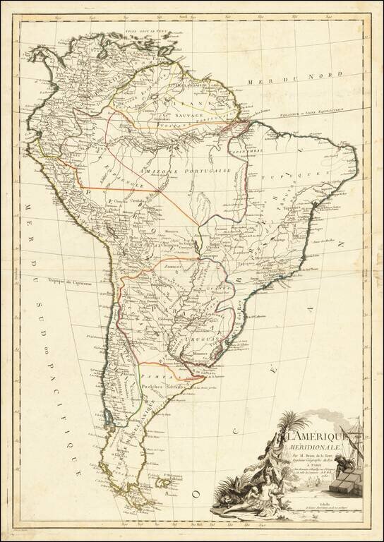
Decorative map of South America, published in Paris by Jean Janvier. A classic example of the French unwillingness to enhance maps with speculative cartography. Large decorative cartouche.
Previously Unknown First State of the Franz Xavier Veigl / Petrus Parcar Map of The Upper Amazon Region - Ecuador - Peru Rare Jesuit map of the Upper Amazon, including a large portion of Ecuador, Peru, northern Bolivia and the Brazilian Amazon State,...
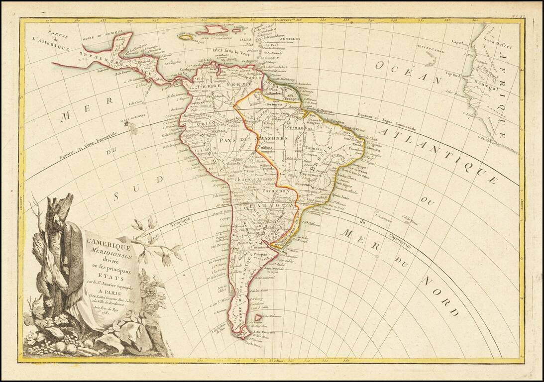
Detailed map of South America, on the eve of its century of Revolution. Still shows the colonial details of Spain and Portugal.
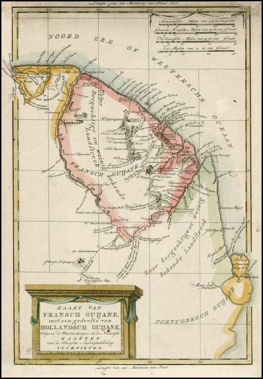
Detailed map of the Guyana Colonies, from a scarce Dutch Atlas published by Bachienne. While derived from French sources, this map is far mor attractive and better engraved than the original by Rigobert Bonne.
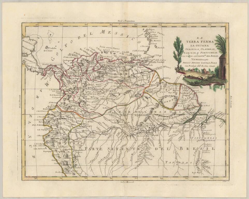
Marvelous map of Columbia, Venezula, Ecuador and a large portion of Northern Brazil, including the entire Amazon River, plus Northern Peru. Includes a large decorative title cartouche. The map was issued in Zatta's Atlante Novissimo, a monumental 4...
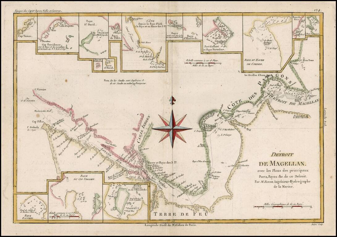
Detailed map of the Straits of Magellan from Bonne's Atlas Supplement. Shows the direction of the currents, bays, points, soundings, harbors, islands, shoals, etc. Includes the best route through the straits as known at the end of 18th century....
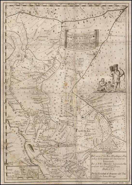
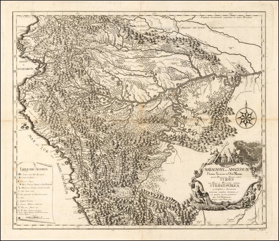
Extremely rare first edition of this important early map of part of northeastern Peru with the Marañon River at the top, the Ucayali River at right, the Huallaga River in the center and Lima at lower left, prepared from the original manuscript maps of...
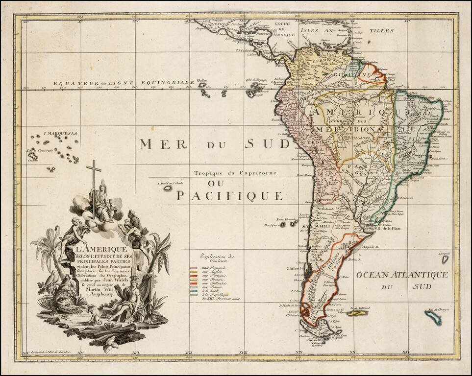
Very rare map of South America, published in Augsburg. Includes an elaborate cartouche, including a large allegator.
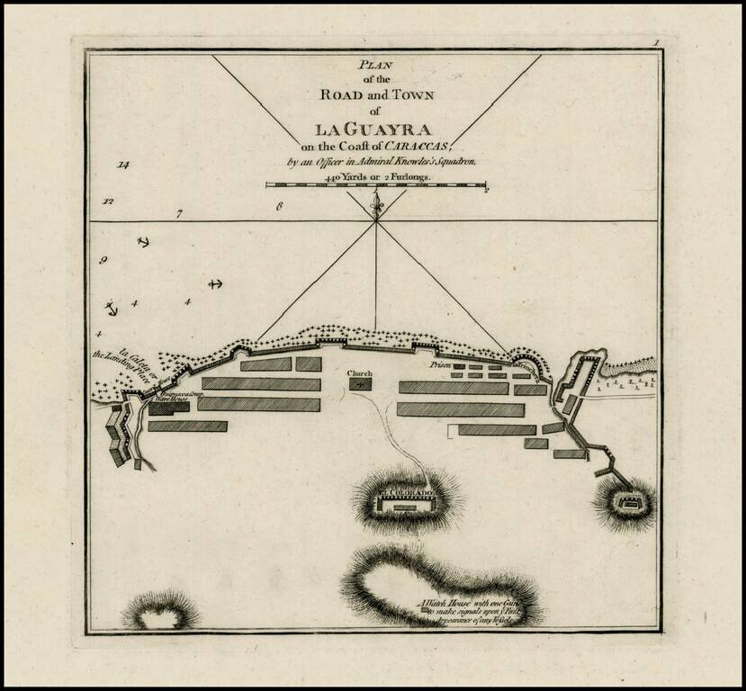
Rare plan of the harbor and town of Guayra in Venezuela, published by Laurie & Whittle. The plan shows soundings, "the Landing Place" a Warehouse, Church, prison, walled fortifications, the watch house, and other details. The map was the site of...
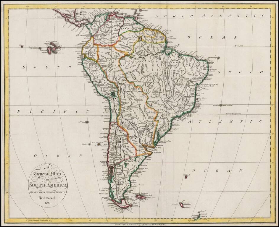
Nice example of Russell's map of South America, on the eve of its Century of Revolution.
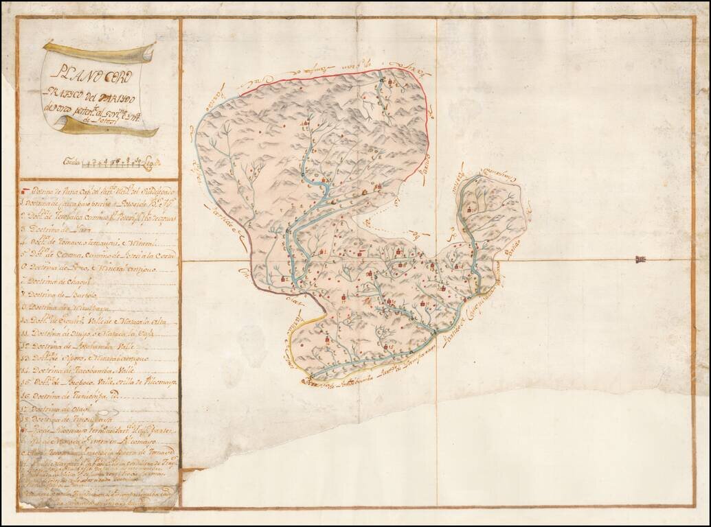
Finely Executed Spanish Colonial Government Survey Manuscript Map of the Porco District of the Mining Region of Potosi in Bolivia Remarkably detailed manuscript map of the Porco district, part of Potosi, one of the richest mining regions in the world,...