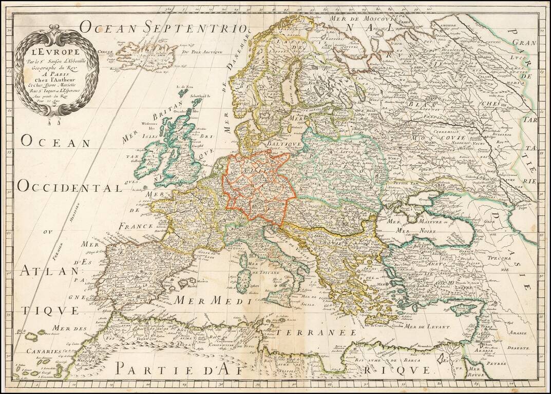
Nicolas Sanson's circa 1651 double-page engraved map of Europe, a super example of the 17th century French School of mapmaking. The aesthetics of the map are characteristic of Sanson; it utilizes attractive typography and a well-engraved cartouche, in...
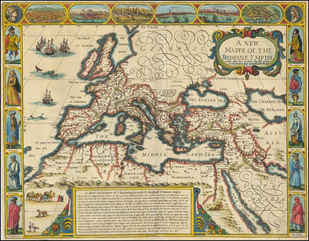
First Edition of Speed's Map of the Roman Empire Striking example of Speed's map of the Roman Empire. The map focuses on the Mediterranean and the regions dominated by Rome at the height of its empire. Includes views of Rome, Venice, Genua,...
Rare English map of Europe, published in London by Robert Walton. Walton's map shows all mainland Europe, extending northwards beyond North Cape to include Greenland, Nova Zemla, and Sir Hugh Willoughby's Land. This last place was named after the...
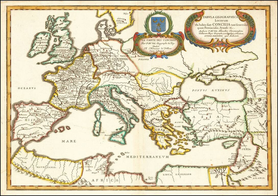
Finely colored example of Du Val's map of Europe, the Mediterranean and Asia Minor. Du Val's religious-historical map of Europe extends to include northern Africa and a portion of the Middle East. Locations of general and provincial councils and...
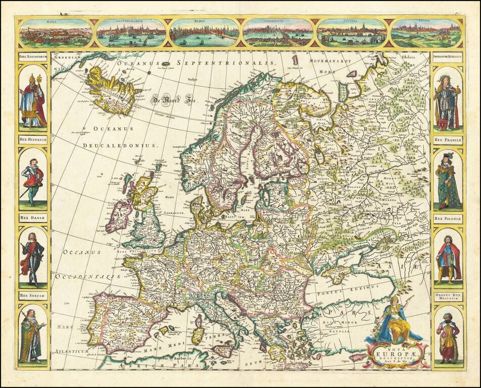
Decorative carte-a-figures map of Europe, published by Frederick De Wit. The map includes the cities of Rome, Amsterdam, Paris, London, Seville and Prague across the top, and decorative costumed figures of Europeans at the side borders.
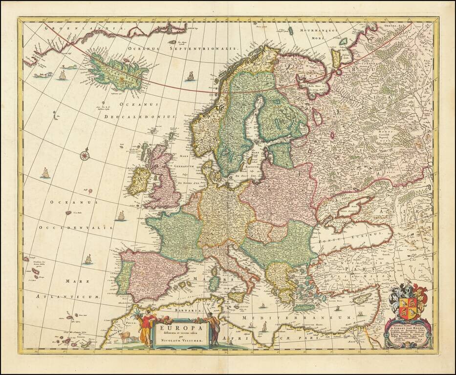
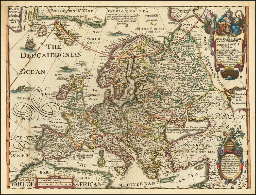
Fine old color example of Nicolas Visscher's map of Europe. Among the many great Dutch map publishers active in the 17th Century were the Visscher family, begun by Claes Jansz Visscher (1587-1652) and continued by his son Nicolaas (1618-1679),...
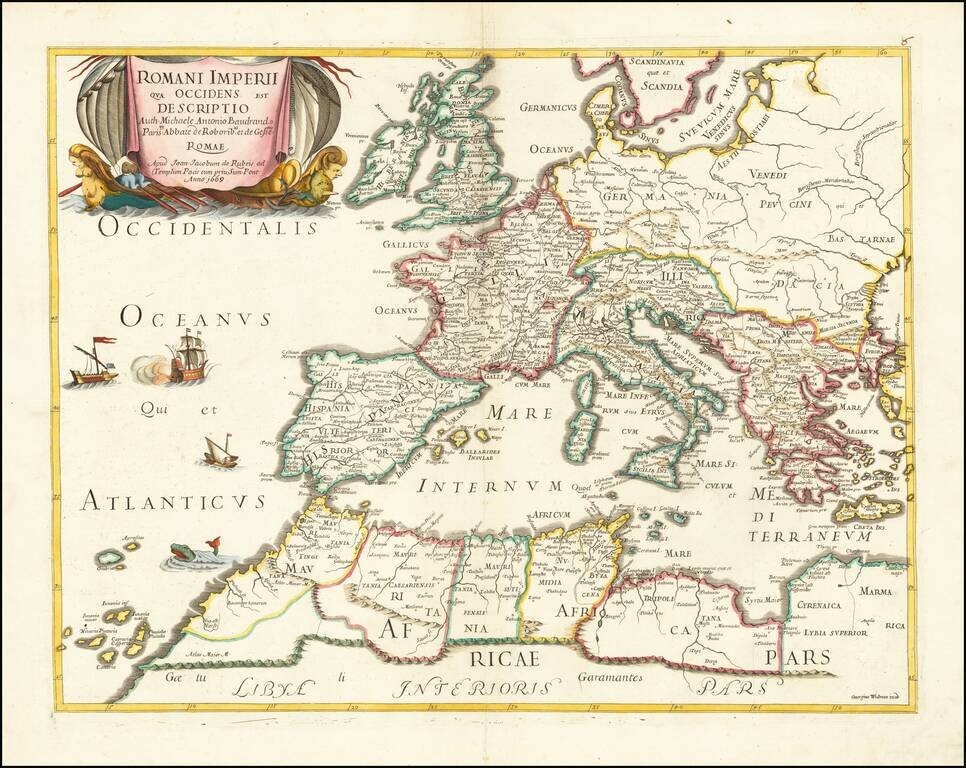
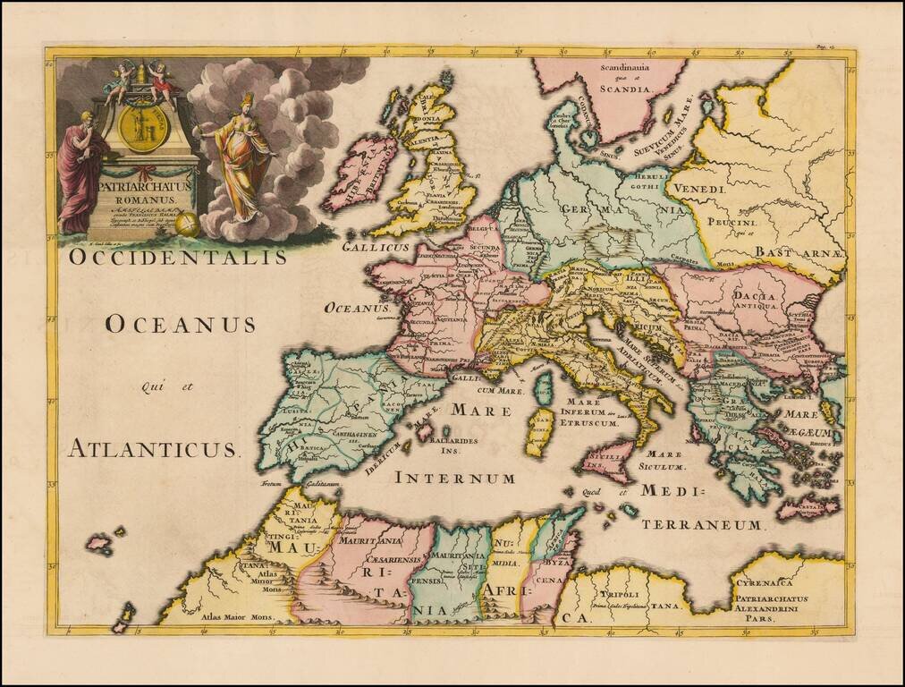
Rare map of the Roman Empire and contiguous regions. This map was originally designed by Michel Antoine Baudrand (1633-1700), a French Historian and Geographer, who served as secretary to Cardinal Francesco Barberini (then Dean of the College of...
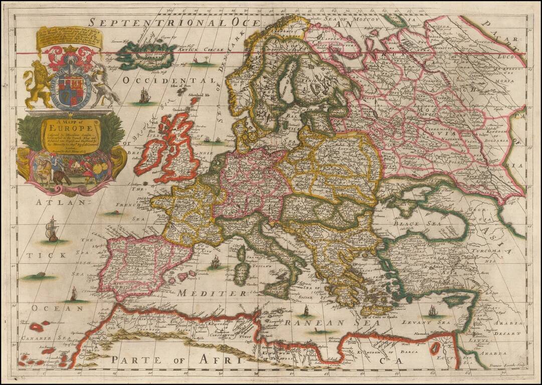
Fine Old Color Example of Richard Blome's Map of Europe Old color example of Blome's scarce map of Europe, the earliest folio size map of Europe to be engraved and printed in England. The map demonstrates the naïve engraving style characteristic of...
![Parte Occidentale Dell' Europa . . . [and] Parte Orientale Dell' Europa . . . [Coronelli's 2 sheet map of Europe]](/map/small/35480.jpg)
Nice example of Coronelli's 2-sheet map of Europe. The map extends from Iceland (Volcanoes shown) and the coast of North America to is embellished Russia, Ukraine and the Caspian Sea, and includes 2 decorative cartouches, a sea monster being attacked...
Fine example of Francois Halma's map of the Roman Empire. The map shows regional sub-divisions within the Roman Empire. A striking example of this decorative map.
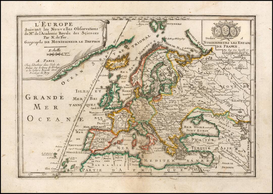
Striking map of the continent of Europe from Nicholas de Fer's L'Atlas Curieux ou le Monde. This example is the first state, dated 1700. The map shows large German and huge Polish Empires, bordering Turkey in Europe. Iceland and Greenland are depicted...
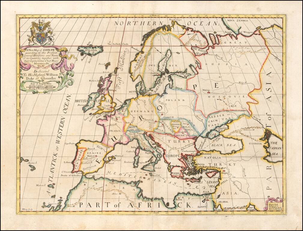
Decorative map of Europe at the beginning of the 18th Century. This map was part of an atlas dedicated to the Duke of Glocester, who was then attending school in Oxford.
Decorative map Europe, Iceland and part of Greenland, with sea monsters and land creatures in the sea and on land. Large decorative cartouche and characters. Scherer's Atlas Novus was a 7 volume compendium which demonstrated his unique style and...
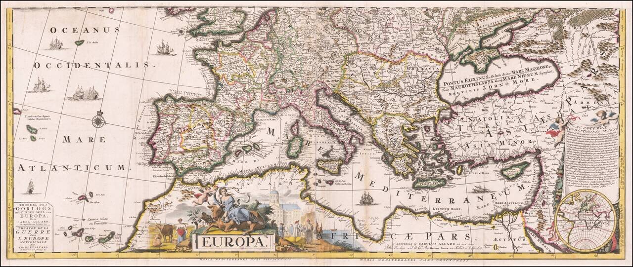
Striking Map of Europe at the Bellicose Beginning of the Eighteenth Century Rare map of the theater of war in Europe, published by Carol Allard in Amsterdam. It shows southern Europe as it looked during the War of Spanish Succession. The wide map...
![[Total Eclipse of 1706] Eclipseos Solis Totalis cum mora, d: 12 Maji 1706, horis antem: in Europa celebratae, Geographica Repraesentatio, in qua Centralis Umbrae Tractus ac reliquae Magnitudines suis locis cometentes, ex Illustrium Virorum observationibu](/map/small/58590.jpg)
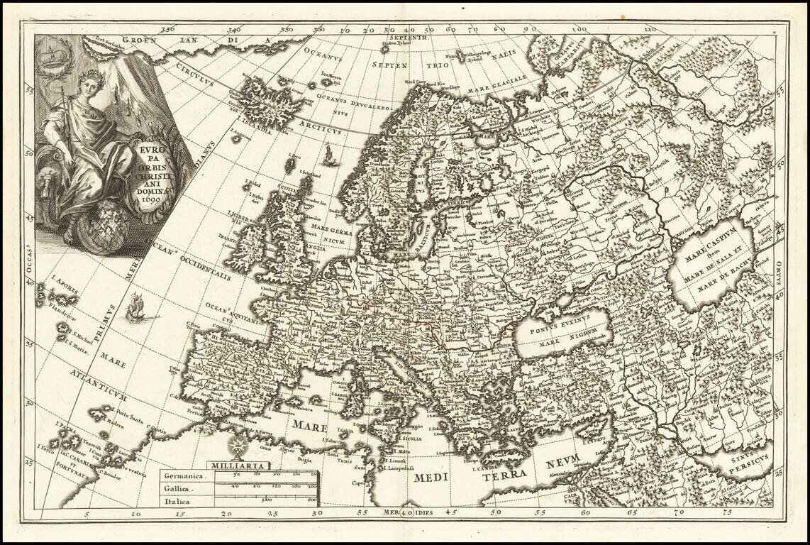
Mapping The Total Eclipse of 1706 Extremely rare Doppelmayer Eclipse map, overprinted on Homann's rare map of the Christian dominions of Europe (Europa Christiani Orbis Domina in sua Imperia, Regna, et Status exacte divisa . . . ). The map depicts...
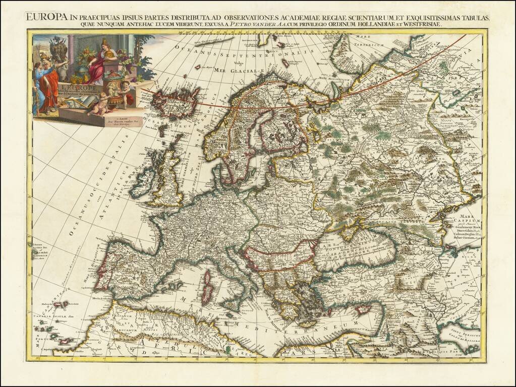
Beautifully engraved map, from the larger-format suite of continental maps made by Van Der Aa in 1713. The map stretches from the Caspian in the east to Iceland (albeit incorrectly located) in the west. These Van Der Aa continental maps are...