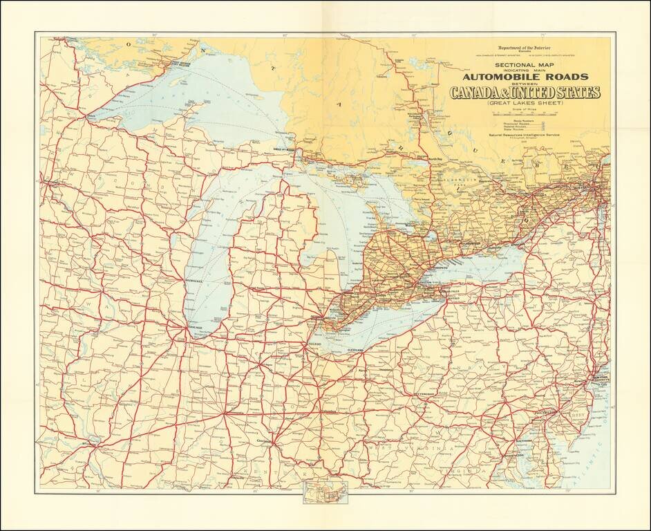
Detailed road map of the Great Lakes Region, constructed by Canada's Department of the Interior. Includes Provincial Routes, Federal Routes and State Routes.
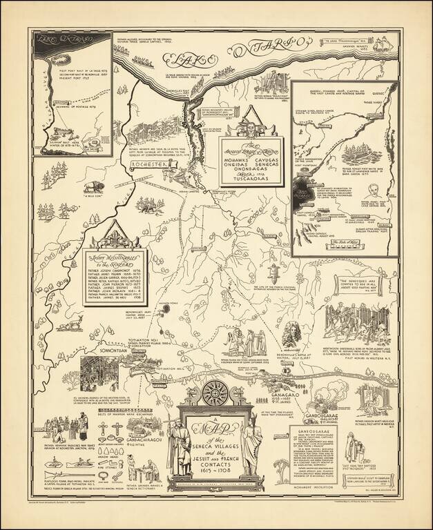
Rare historical pictorial map of the Iroquois League of Nations, consisting of the Mohawks, Cayugas, Oneidas, Senecas and Onondagas and later the Tuscoras, who dominated this region in the 17th and 18th Centuries. The work focuses on the regional...
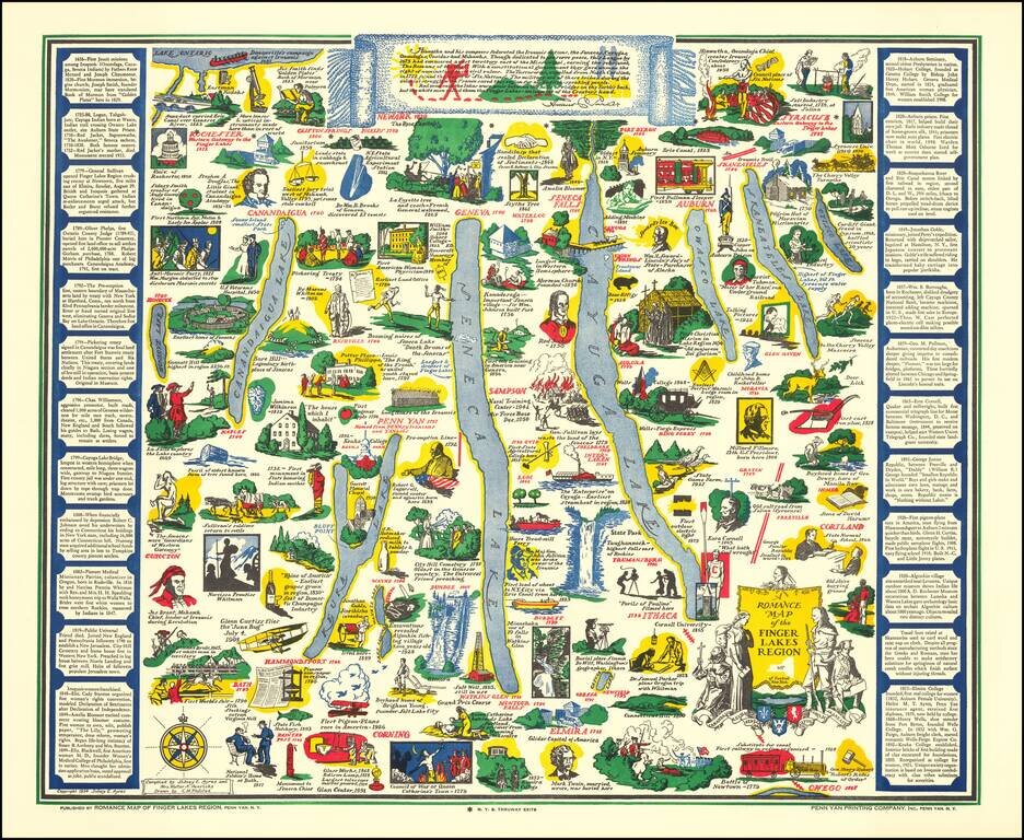
Decorative pictorial map of the Finger Lakes Region of New York. Provides numerous historical vignettes and facts about the region. Compiled by Sidney E. Ayres and Mrs. Walter A. Henricks.
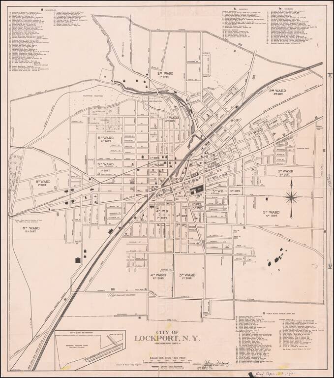
Detailed map of Lockport, New York, published for the Commissioner of Public Works. Includes an extensive list of public buildings, hotels and lodges at the bottom of the map, as well as industries, schools, and churches.
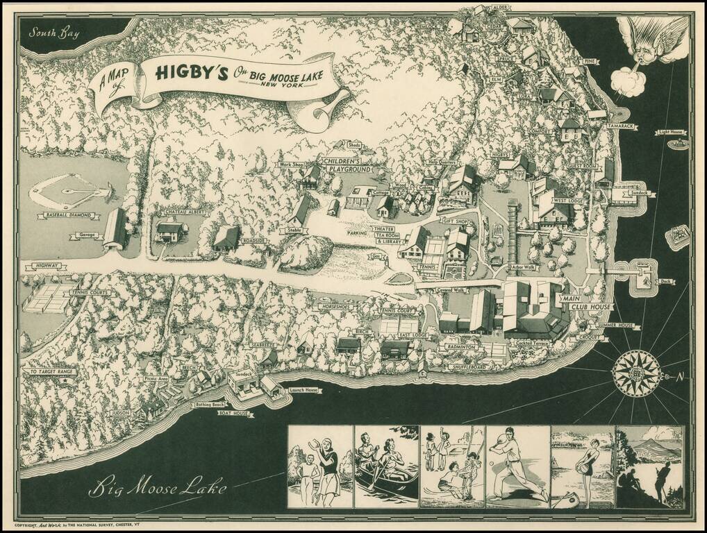
Scarce pictorial map of Big Moose Lake. As noted by Rumsey: Pictorial map of Higsby Campground on Big Moose Lake, New York. Shows roads, trails, beaches, buildings, Campgrounds, Sports and Recreation Facilities. Buildings are named. On bottom...