Map size in jpg-format: 36.8561MiB
Click to open in high resolution (open in new tab).
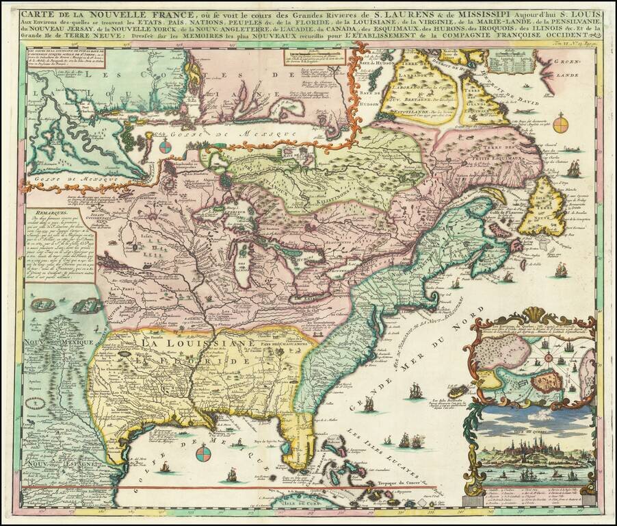
Fine full color example of Henri Chatelain's map of the inhabited parts of North America, based upon Nicholas De Fer's landmark 4 sheet map published in 1718.
At the top left of the map is large scale map of the Mississippi Delta and Mobile Bay, based upon the 1699 voyage of Pierre Le Moyne d'Iberville. The inset also appears on De Fer's rare 4 sheet map of 1718, upon which this map is based.
D'Ibeville explored the mouth of the Mississippi and its many tributaries, including the Red River in Arkansas. This map was first issued in Volume 6 of Chatelain's 7 volume Atlas Historique, published between 1705 and 1720. Heidenreich and Dahl surmised that the original 4 sheet De Fer map was issued to promoted the recently established Compagnie Francoise Occident and reinforce French opinion in the 1713 boundary settlement. The settlement was initially successful in promoting French emigration to America. However, the financing side of the company, conceived by John Law to help finance the debt left by Louis XIV, led to a wild burst of speculation and ultimate collapse. This episode is often referred to as the Mississippi Bubble.
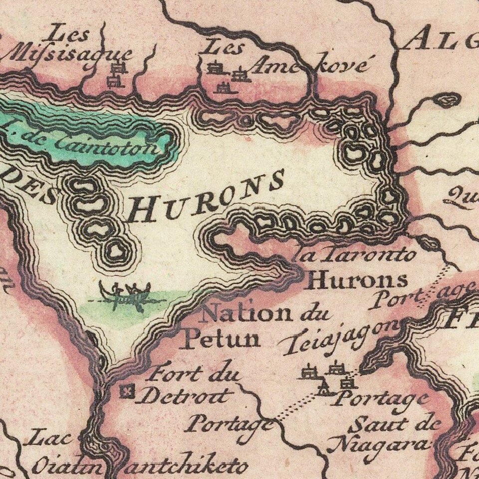
Chatelain's one sheet version of De Fer's map proved very successful and was copied by Van Keulen and Ottens. The map includes a a nice plan and view of Quebec, and fine detail in the Great Lakes and Mississippi. The map features vignettes and notes throughout and a dozen sailing ships, Indian Villages, etc.
If you are a student, write to us in telegram: @antiquemaps and indicate what material you need and for what work you need a map in high detail. We are ready to provide material on special terms. For students only!
![[Signed Political Satire Artwork] Vietnam ... Vietnam ... Vietnam ...](/map/small/68726.jpg)