Map size in jpg-format: 99.5203MiB
Click to open in high resolution (open in new tab).
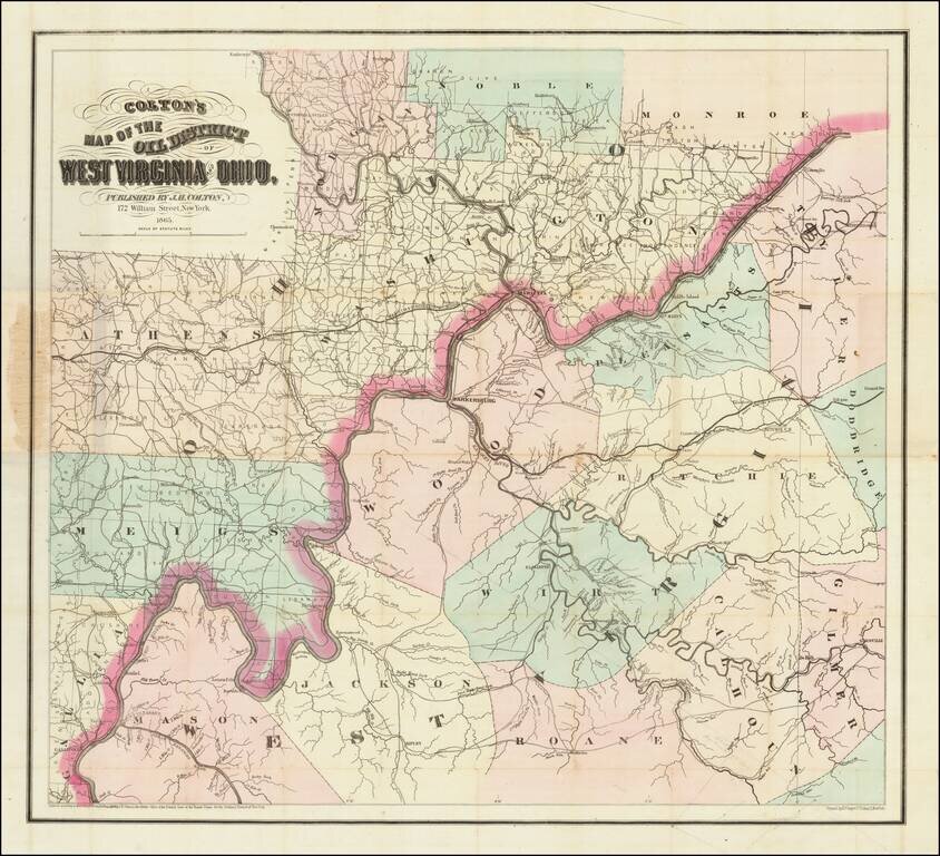
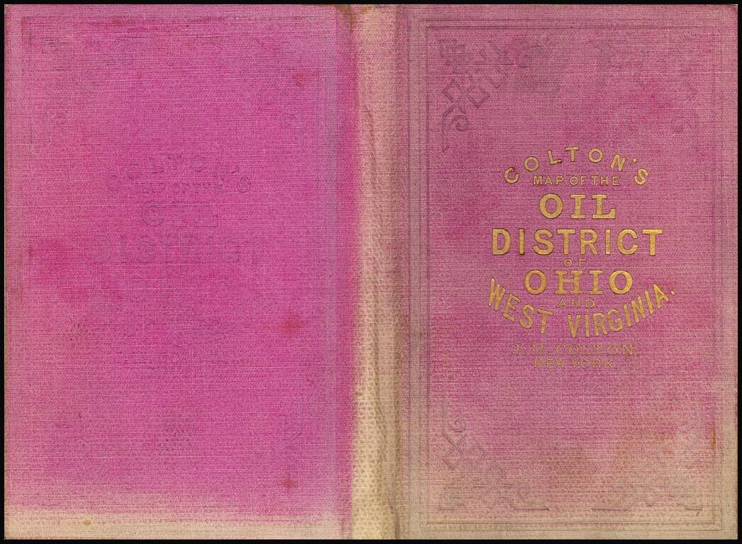
Scarce First State of Colton's Map of Some of the Earliest Oil Fields in the United States.
Hand-colored lithographed map of the West Virginia oil region off the Little Kanawha River. Colton published the map in New York in 1865.
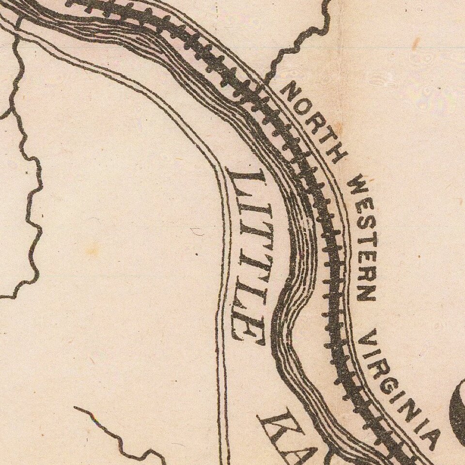
The map shows a concentration of oil wells along the North Western Virginia Railroad and Walkers and Goose Creeks, including "Welling Co. Wells 15 Wells worked by 1 Engine". There are other "oil regions" scattered along creeks elsewhere in West Virginia on the map. In Ohio north of Marietta, there are named oil wells, gas wells, and coal scattered around. Many of the creeks and streams are labeled "Oil" "Oil" "Oil" giving the sense that the rivers are overflowing with oil.
The West Virginia Geological and Economic Survey gives the following summary of the early history of the oil and gas industry in West Virginia:
The oil and gas industry in West Virginia actually began as an outgrowth of the salt industry. In the early 1800s, oil and gas had no importance in West Virginia, and though saltmakers frequently hit oil or gas in their drilling, they considered it a nuisance. In fact, so much oil was diverted to the Kanawha River by salt manufactures that it was long known as "Old Greasy" to the boatmen. Gas was first struck in a well drilled for salt at Charleston in 1815. Once the value of oil and gas was realized, the Great Kanawha Valley region became a pioneer in the discovery of petroleum by boring and in the use of oil and gas on a commercial scale. By 1826, oil was used for lamps in workshops and factories. The drilling tools, jars, and casing, first developed in 1806 by the Ruffner brothers for the salt industry, became essential equipment to the petroleum industry of the United States.
On the Little Kanawha River, near the Hughes River, was a stream called Burning Springs Run, named because there were two springs at its mouth from which natural gas escaped. As early as 1781, Thomas Jefferson described the brilliant flame which could be produced by thrusting a lighted candle into the escaping gas at this site. Because gas and salt brine were often associated, the Rathbone brothers bored a salt well near these springs. However, rather than salt, at a depth of 200 feet they hit petroleum and by boring deeper, they were able to produce 200 barrels per day in 1859. Although petroleum was not the treasure that the Rathbones sought, they were encouraged by their find and drilled a second well which yielded 1,200 barrels of petroleum daily. News of the Rathbone brothers' discovery spread rapidly and created tremendous excitement. By 1861, a town with several thousand inhabitants had sprung up. All of the light in the newly-formed town, including that for a brilliantly lit hotel, was provided by natural gas. The widespread use of gas in this town marked the beginning of the era of gas development in West Virginia. Meanwhile, hundreds of thousands of barrels of oil were being floated down the river to Parkersburg where they were then sent to other cities by rail or river. The Burning Springs oil field was one of only two oil fields in America prior to the Civil War. But by 1876, there were 292 wells in the State, producing a total of 900 barrels daily. Parkersburg was the chief oil market.
If you are a student, write to us in telegram: @antiquemaps and indicate what material you need and for what work you need a map in high detail. We are ready to provide material on special terms. For students only!