Map size in jpg-format: 3.44373MiB
Click to open in high resolution (open in new tab).

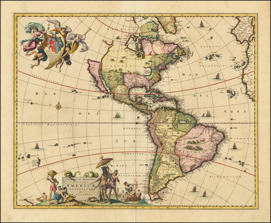
Scarce map of America, published in Amsterdam by Gerard Valk.
Valk's map of California shows many of the most fascinating myths of the 17th Century. California is shown as an island on the so-called "second Sanson Model." A massive land bridge extends from just west of Capo Blanco on the northern California coastline to Niphon, a curious adaptation of the legend of Compagnie Land (shown here as a place name -- Terre de la Compagne) and the continuous land bridge from America to Asia, although adding the Detroit de Tzungaar (Strait of Tzungaar), a very rarely mentioned mythical Strait between two islands of Japan.
The Great Lakes are oddly configured, with Lake Superior and Lake Michigan open ended to the West. The Mississippi River is very ill conceived, pre-dating the radical improvements which would come with Guilluame De L'Isle's map of North America of 1700 and Carte du Mexique of 1703.
The fine allegorical cartouches depict teh booming trade then being conducted by Europeans in the New World.
If you are a student, write to us in telegram: @antiquemaps and indicate what material you need and for what work you need a map in high detail. We are ready to provide material on special terms. For students only!
![[The Second Map of California as an Island!] Zwoelffter Theil der Newen Welt...](/map/small/68875.jpg)
![L'Amerique Autrement Le Nouveau Monde et Indes Occidentales . . . 1664 [1st complete state]](/map/small/68897.jpg)