Map size in jpg-format: 36.3874MiB
Click to open in high resolution (open in new tab).
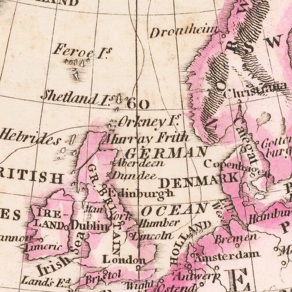
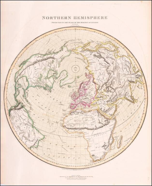
Interesting and highly detailed map of the Northern Hemisphere, published by John Thomson.
Includes an unusual orientation such that all of Asia, Europe, Africa and North America are shown.
Includes the tracks from Cook's voyages, along with dates and direction of his course. A very attractive and interesting map, illustrating the still incomplete knowledge of the polar regions and the northwest passage.
One of the best large format English maps of the period.
John Thomson (1777-ca. 1840) was a commercial map publisher active in Edinburgh. He specialized in guide books and atlases and is primarily known for his Atlas of Scotland (1832) and the New General Atlas, first published in 1817 and reissued for the next quarter century. The New General Atlas was a commercial success—it was also published in Dublin and London—and it compiled existing geographic knowledge in compelling ways for a wide audience.
His Atlas of Scotland introduced new geographic information and was the first large-scale atlas of Scotland to be organized by county. It provided the most-accurate view of Scotland available before the Clearances. Work on the atlas began in 1820 and led to Thomson’s bankruptcy in 1830 due to the high costs of gathering the latest surveys and reviewing the required materials. Despite the publication of the atlas, Thomson declared bankruptcy again in 1835.
If you are a student, write to us in telegram: @antiquemaps and indicate what material you need and for what work you need a map in high detail. We are ready to provide material on special terms. For students only!
![[Proietio Optica Hemisphaerii Polaris Arctici]](/map/small/59287.jpg)