Map size in jpg-format: 11.5147MiB
Click to open in high resolution (open in new tab).

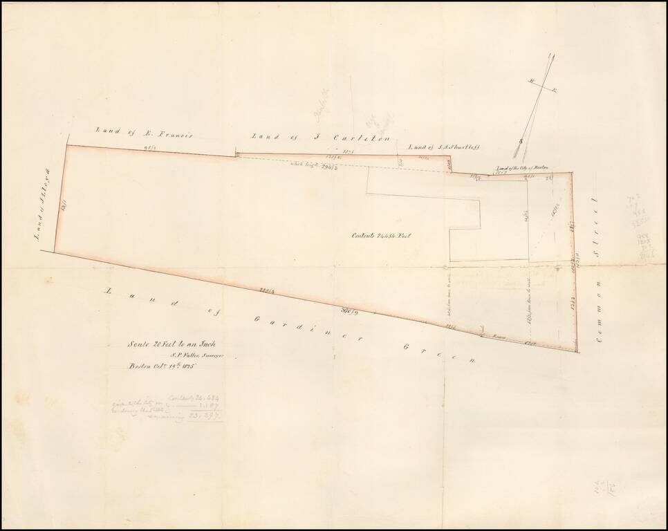
Detailed map of the area west of Common Street, which is now Winthrop Square and the location of the Freedom Trail, Training Field and Soldier's Monument.
The lands owned by Gardiner Green are shown. The map is described on the verso as
The map was drafted by Boston Surveyor S.P. Fuller on October 19, 1825.
The note below Fuller's signature identifies the area of the survey as 24,484 (sq feet?), less 1,187 square feet apparently "given to the City on widening the street.."
Names given on the map include:
If you are a student, write to us in telegram: @antiquemaps and indicate what material you need and for what work you need a map in high detail. We are ready to provide material on special terms. For students only!