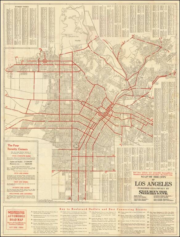
Detailed vintage street map of the City of Los Angeles, prepared by The Clason Map Company for the Security Trust & Savings Bank, and published in Los Angeles in 1921. The primary map covers the City of Los Angeles north of Manchester and the...
This is a fantastic pamphlet detailing Los Angeles during the 1920s. The booklet, replete with many photographs and descriptions, painting a marvelous picture of the region as it lay a century ago. This is the thirty-second edition of this work...
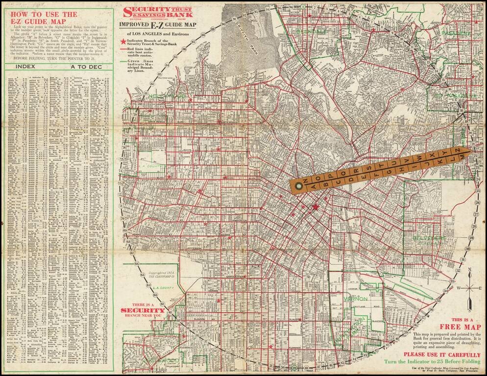
Rare folding map of Los Angeles and Vicinity, with riveted rotating pointer. Interesting promotional map for Security Trust & Savings Bank, with an Index and direction on how to use the map, which shows the locations of the bank's branches,...
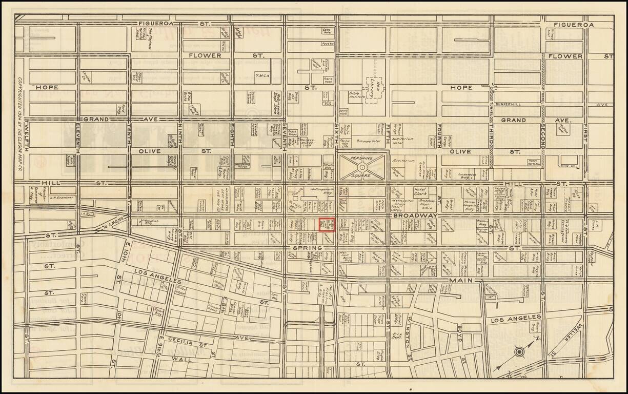
Detailed map of downtown Los Angeles in 1924, featuring building-level detail and an extensive enumeration of businesses in the area. The map is roughly bounded by Figueroa on the west, Wall Street on the east, First Street in the north, and Twelfth...
![[Catalina / Avalon] The Island for Rest and the Sport You Love Best](/map/small/70008.jpg)
Striking pictorial view of Avalon Bay, promoting the Wilmington Transportation Company's excursions to Catalina. The view provides a fine overview of the Avalon Area, including the residence of William Wrigley Jr. on the hillside at the left and the...
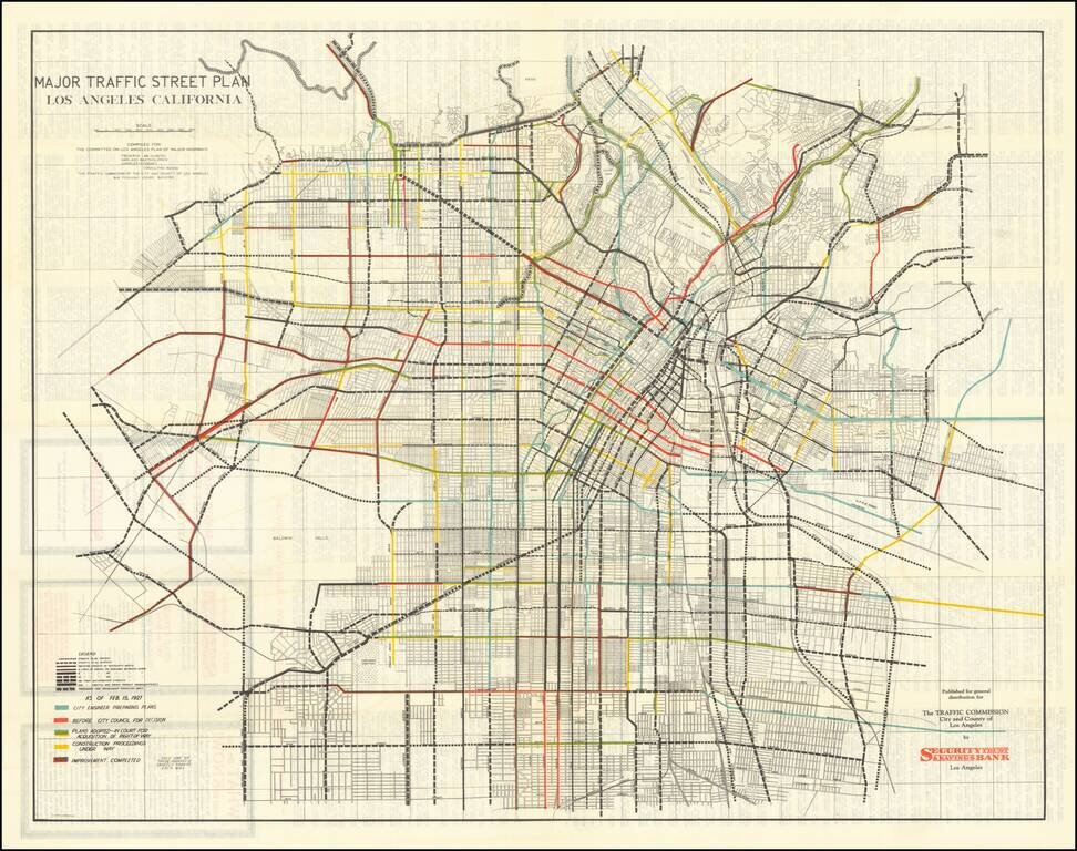
Early Los Angeles Transit Planning Rare separately issued folding map, showing the general plan for major streets prepared by the Los Angeles Traffic Commission, with one the commissioners including Frederick Law Olmsted, Harland Bartholomew, and...
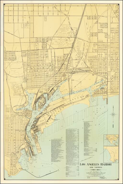
Highly detailed map of Los Angeles Harbor, first published by the Harbor Department in 1919 and periodically revised thereafter. The map includes a detailed plans for the Wilmington District, Long Beach and San Pedro District, along with excellent...
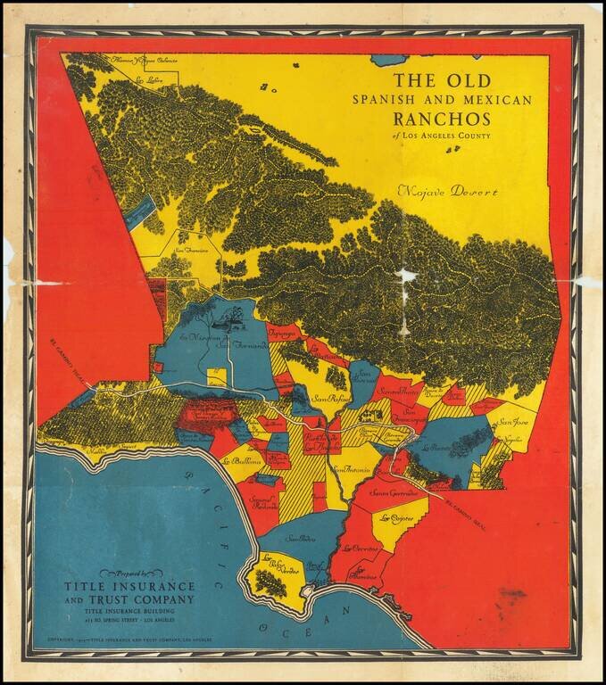
The Earliest of the Pictorial Maps of the Spanish & Mexican Ranchos Published for Title Insurance and Trust Company of Los Angeles Rare early Spanish & Mexican Ranchos map, prepared for the Title Insurance and Trust Company of Los Angeles....
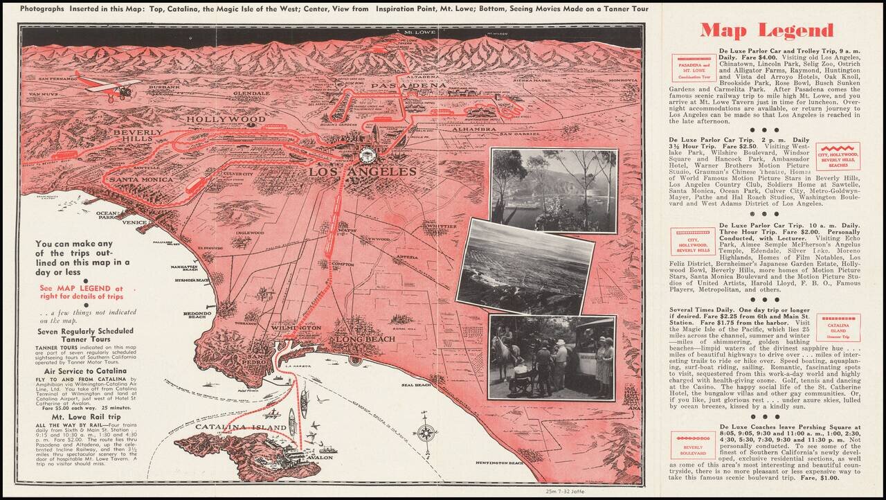
A pictorial map of Los Angeles from circa 1930 with photographs of Avalon, Mt. Lowe, and more. The map itself shows the area from Long Beach to the San Fernando Valley, and eastwards as far as Mt. Lowe and Monrovia. The image is drawn from a birdseye...
Interesting promotional map of the Eastern portion of Los Angeles County, likely published at about the time of the1932 Olympics. The map is centered on Pasadena and the the San Gabriel Valley, stretching north to Lancaster and south to Artesia and...
Detailed street map of 1930s Los Angeles, focusing specifically on Downtown Los Angeles and adjacent neighborhoods. On the verso is a "Map of Western Portions of Los Angeles" also by E.F. Hill, that stretches from Vista Del Mar to Santa Monica. The...
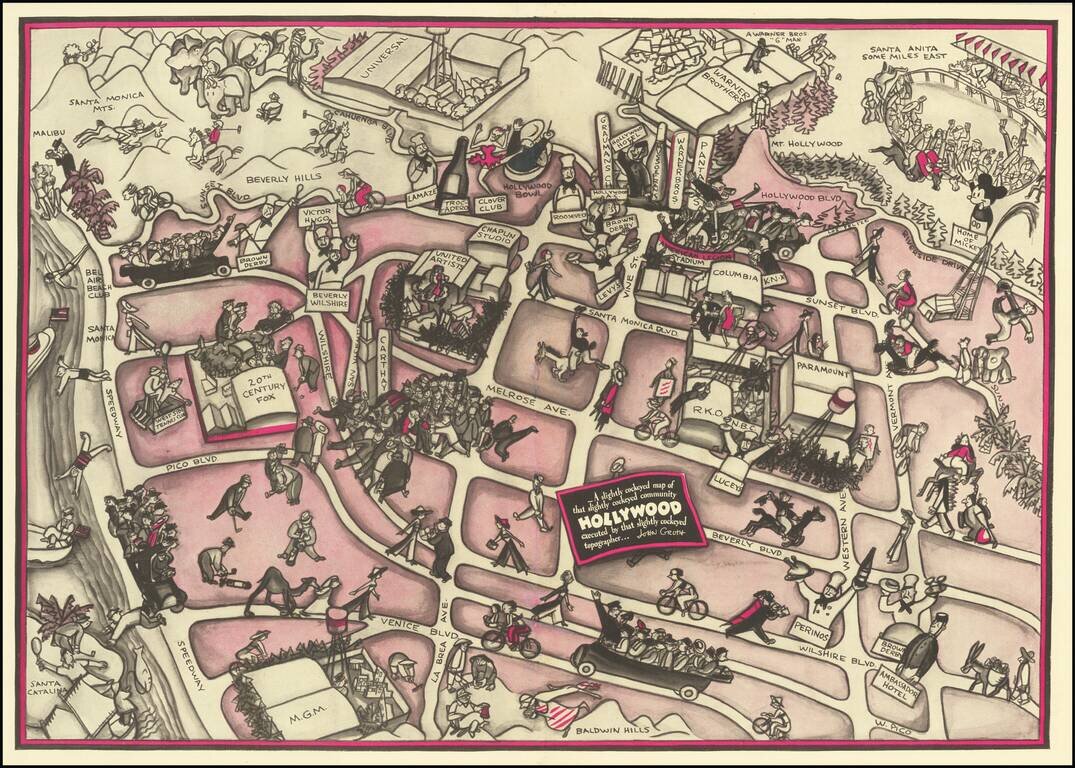
Hollywood in the 1930s Pictorial map of Hollywood section of Los Angeles, also incorporating surrounding areas. Shows streets, locations of film producers and directors, studios, and other points of interest with cartoon illustrations. Landmarks...
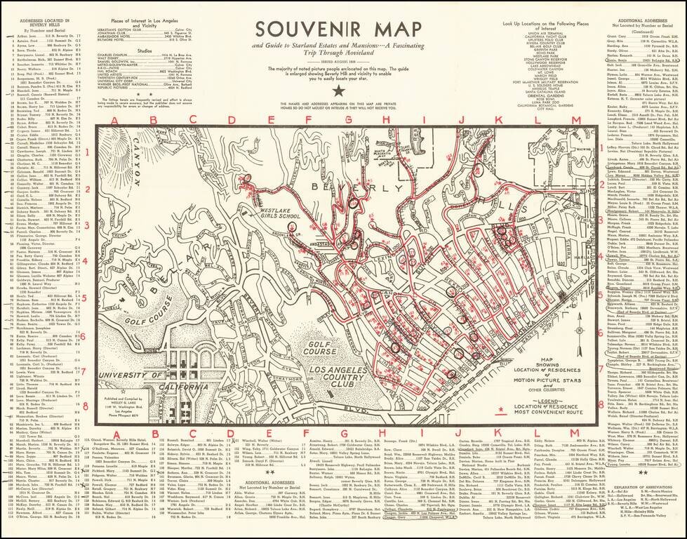
1938 Hollywood Stars Souvenir Map Scarce early map of Beverly Hills and Westwood, showing the locations of prominent movie star homes, published in the August 1938. Stars named include Fred Astaire, James Cagney, Charles Chaplin, Marlene Dietrich,...
![[Los Angeles]](/map/small/63225.jpg)
Striking pictorial map of Southern California, appearing on the verso of the menu for the Ollie Hammond's Steak House in Los Angeles, Feb 2, 1946. The map provides a striking birdseye view of Los Angeles and surrounding areas, along with the location...
![[Official Route Map Los Angeles]](/map/small/70212.jpg)
Los Angeles is the Wonderland of the World and to see it properly is to see it by Streetcar and Coach! Fascinating transportation map of Los Angeles, highlighting the lines of the Los Angeles Transit Company. The map is very interesting in that it...
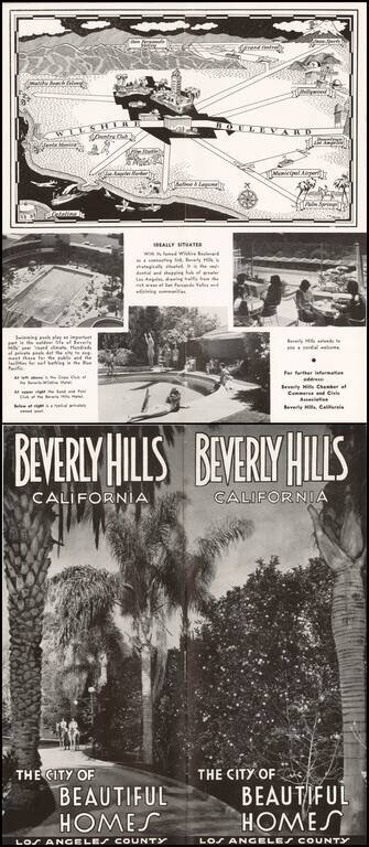
Pictorial map of the Los Angeles Basin, centered on Wilshire Boulevard and Downtown Los Angeles, drawn by C.A. Stanley. Places illustrated include the Malibu Beach Colony, Flim Studios, Municipal Airport, etc.