![[Public Transit in Los Angeles] Los Angeles Transit Lines](/map/small/69627.jpg)
Rare Early Los Angeles Transit Lines Map Fascinating transportation map of Los Angeles, highlighting the lines of the Los Angeles Transit Company. The map very interesting, in that it provides one of the final snapshots of Los Angeles before the...
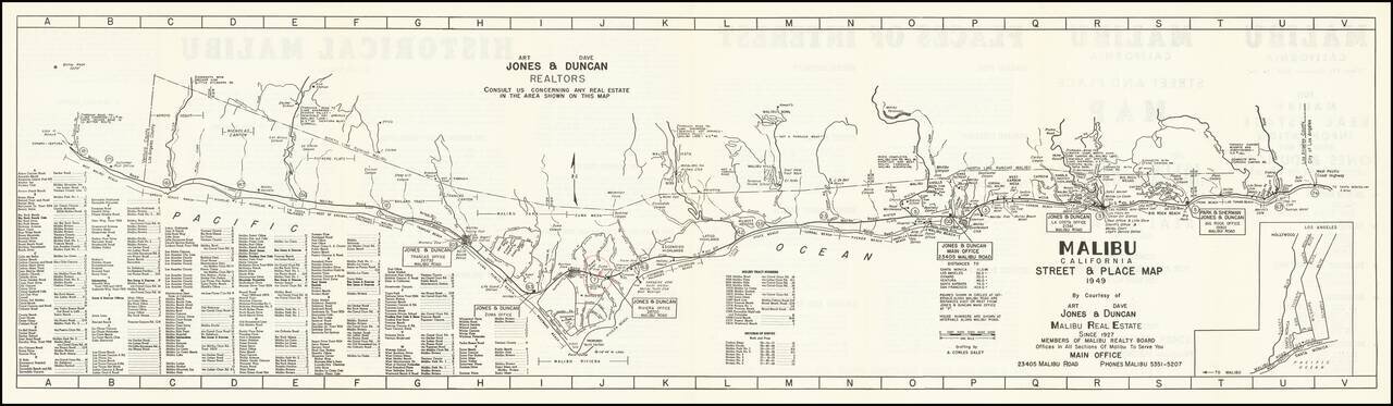
An Early Map of Malibu Rare early promotional map of Malibu, California, published by Art. Jones & Dave Duncan, Realtors, published less than 20 years after the first subdivisions of the area by the Rindge family. Stretching from Topanga Canyon...
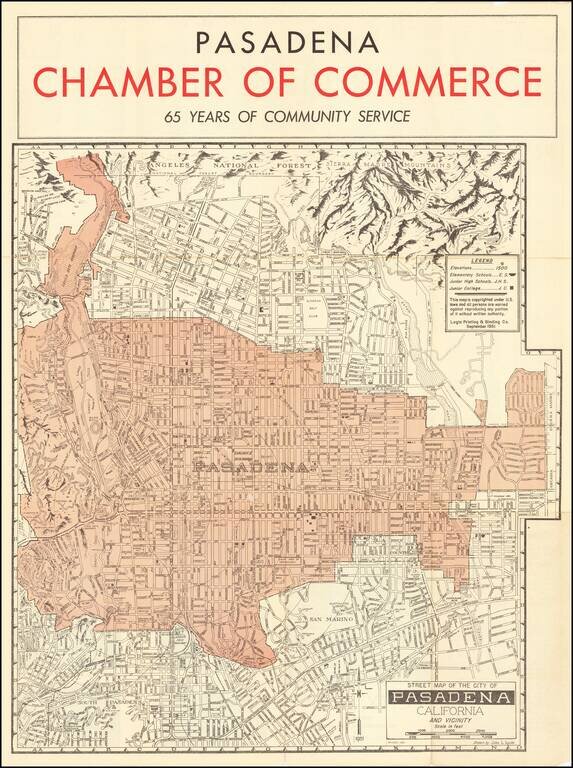
Striking map of the area around Pasadena, including a pictorial representation of the Sierra Madre Mountains and Angeles National in the north. The map is produced by the Pasadena Chamber of Commerce and focuses on the location of local schools in the...
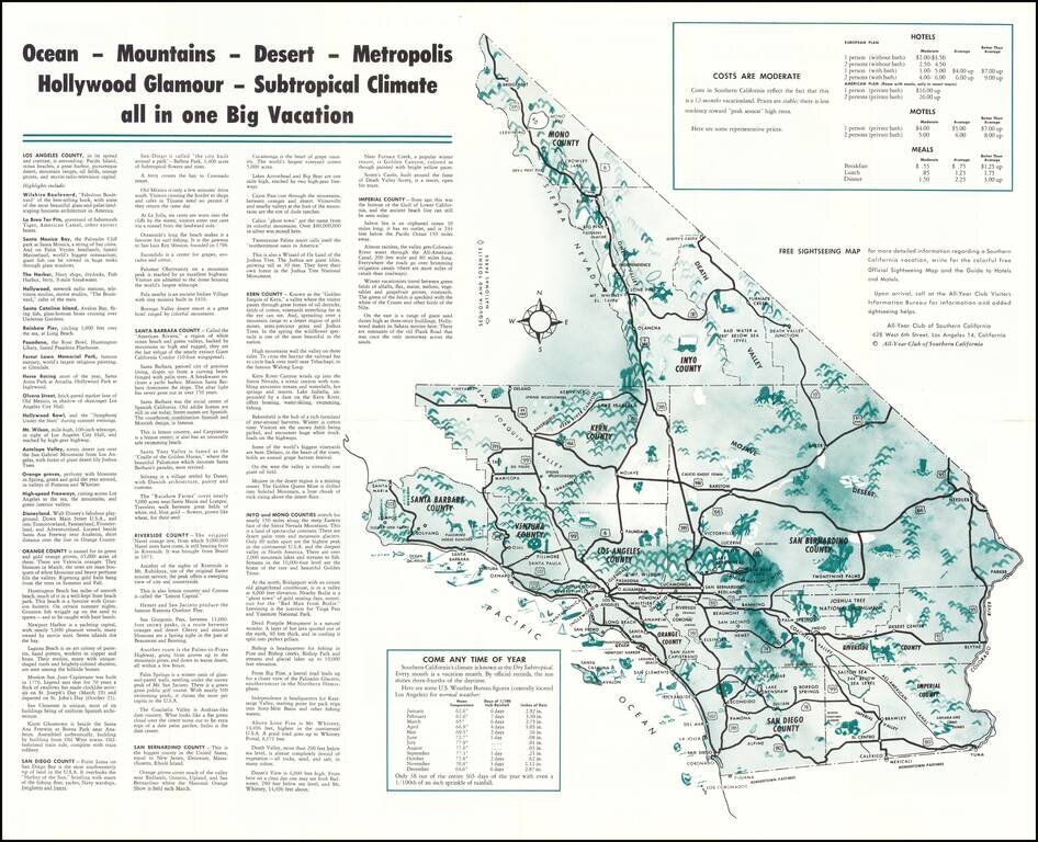
Vintage pictorial map of Southern California, issued by The All-Year Club of Southern California to promote tourism to the region in the middle of the 20th century. The main map includes an overview of Southern California (stretching up to Mono...
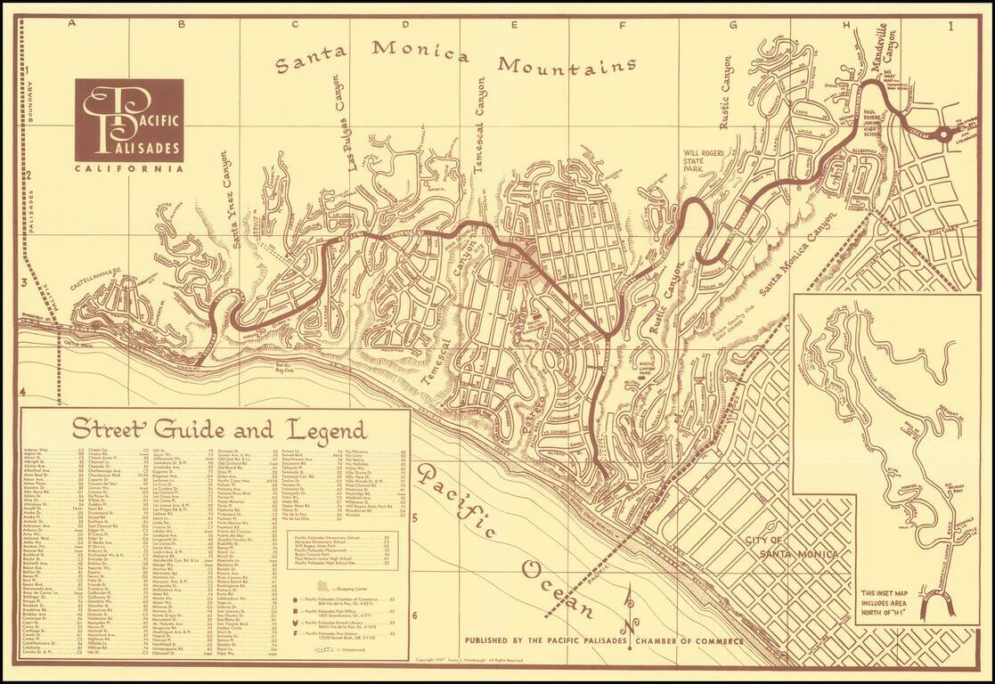
Fine promotional map and separate brochure, promoting the community of Pacific Palisades, Published by the Pacific Palisades Chamber of Commerce, the brouchure includes numerous photographs and testimonial to the benefits of residential life in the...
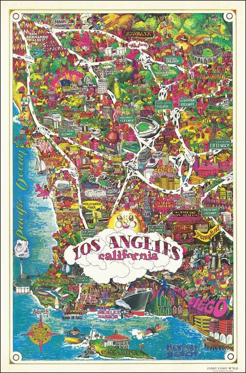
Bright and whimsical pictorial map of Los Angeles, published by Funny Funny World in 1976. The map emphasizes the famous tourist attractions of Southern California, including: Disneyland Queen Mary Marineland Ports of Call Knotts Berry Farm and...
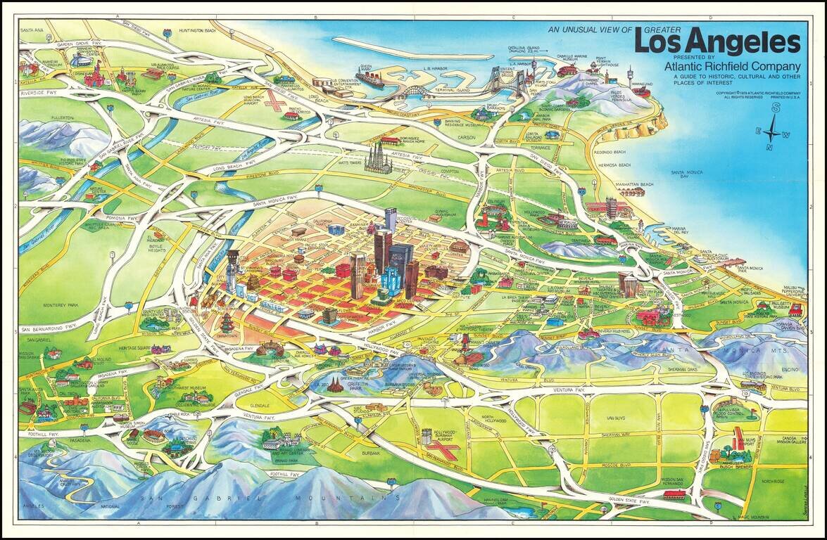
Los Angeles in 1979 -- A Pictorial View Striking pictorial view map of Los Angeles, looking south from above the San Gabriel Mountains toward Long Beach and Palos Verdes. The map was featured in Glen Creason's Los Angeles Magazine on line article,...
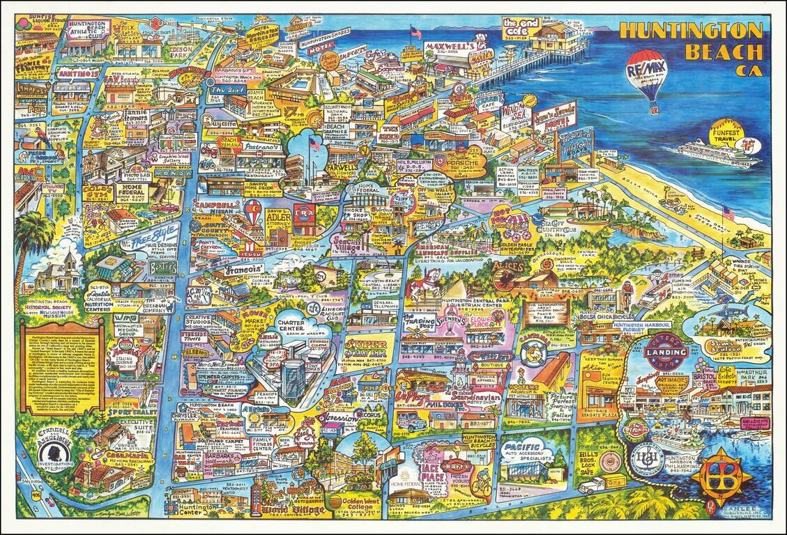
This is a great pictorial map of Huntington Beach, the southern California beachside city. Taken from the north, the map shows the community in bright colors, with the ocean visible on the right. Numerous advertisements dot the map, including many...
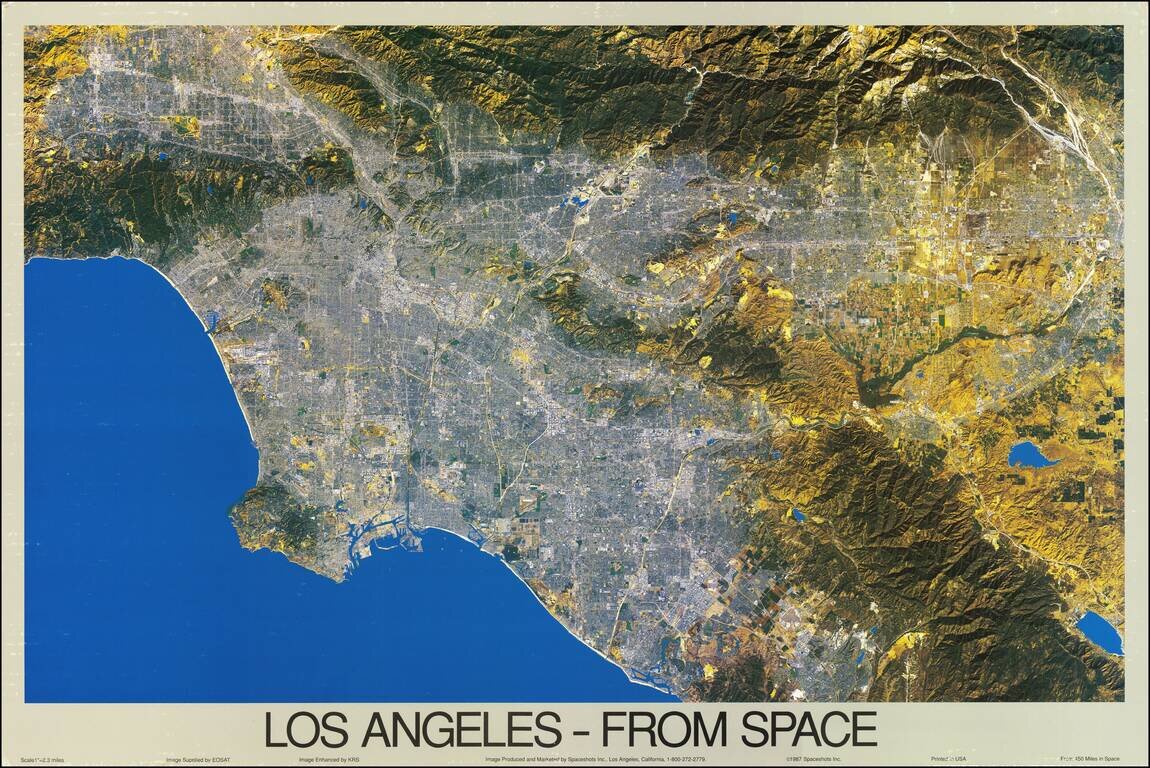
A fabulous color satellite image of Los Angeles, taken 450 miles from the surface of the earth. The scope of the image ranges from the San Fernando Valley to Laguna Beach, and inland past Riverside. The image was taken by EOSAT and printed at a scale...
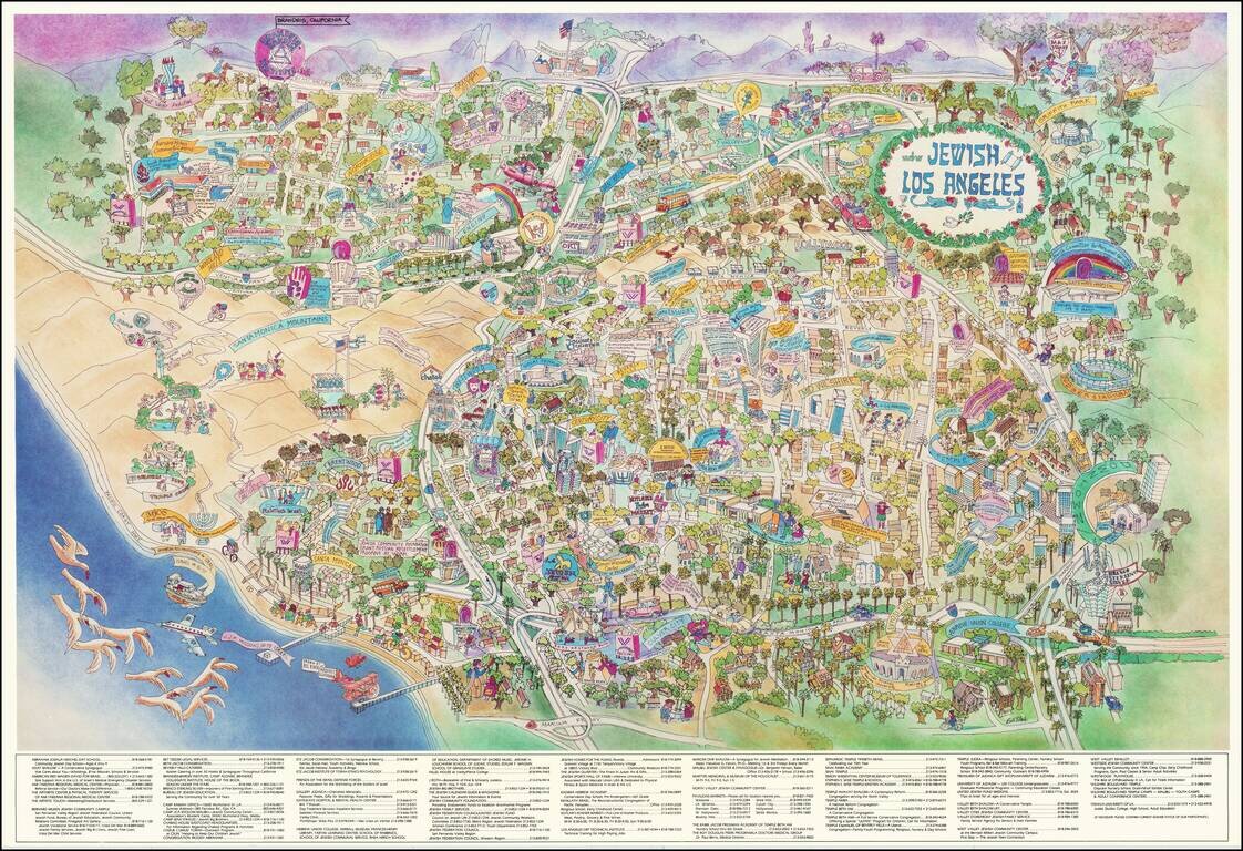
Rare promotional pictorial map of "Jewish Los Angeles," providing a whimsical look at Great Los Angeles and its various Jewish businesses, schools, temples and other public and private institutions. The map includes a directory of businesses and...
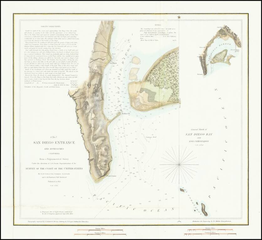
First American Map of the Bay of San Diego Nice example of the first edition of the US Coast Survey's first mapping of San Diego Bay. This first edition can be distinguished from the 2nd edition by the addition of the official seal of the US Coast...
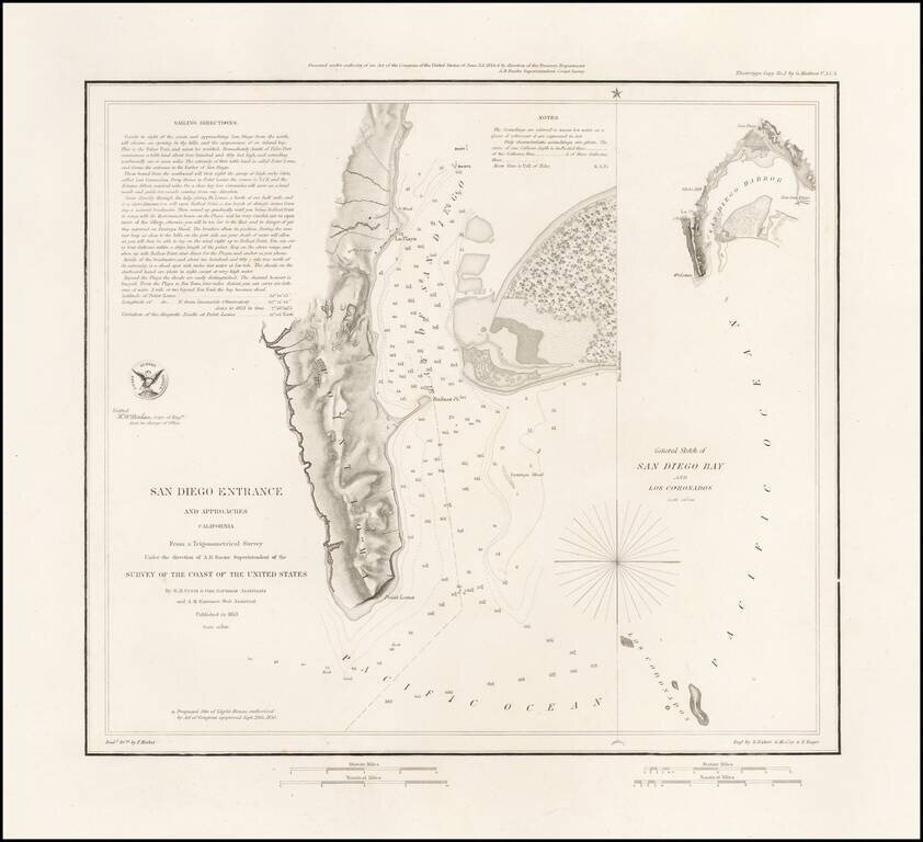
Rare Separately Issued Variant Edition of The First Modern Map of San Diego Bay -- Thick Paper -- Presentation Copy: Rare variant of the 1853 US Coast Survey's first mapping of San Diego Bay. The present example has several changes for the standard...
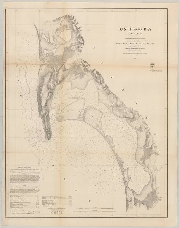
Nice example of the much sought after large format survey of San Diego Bay, form the US Coast Survey. Extends from False (Mission) Bay and the Pacific Beach area, south to Imperial Beach and the Mexican border. Hundreds of soundings. Shows several of...
![[San Diego] Views of Southern California. Prominent Places in and about San Diego](/map/small/69182.jpg)
Rare double page color printed image of "Prominent Places" in the San Diego area, which appeared in The WASP magazine. The views include: Hotel Josephine (Coronado), with Coronado Railroad in the foreground Chadbourne's New Building (4th & C...
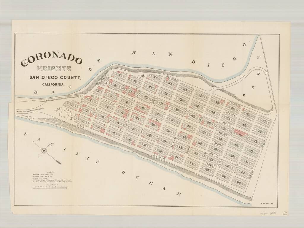
Rare plan of the north end of Imperial Beach, which at the time was planned as a community to be called Coronado Heights, just south of Coronado and the Strand. Located immediately south of the Strand, Coronado Heights would ultimately become a part...
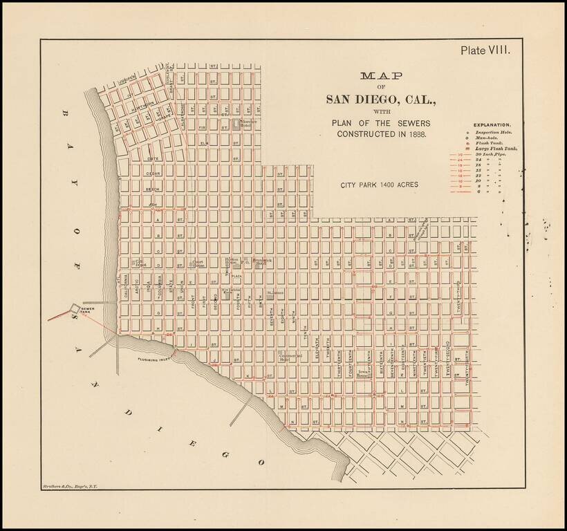
Rare map of San Diego. Shows the Downtown area from Juniper and Curlew Street to 30th Street and N Street. A number of early structures are showing, including: Florence Hotel California Southern Depot Court House Horton House Brunswick Hotel...