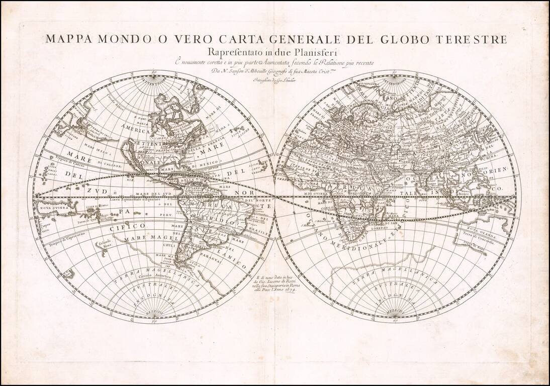
First state of Rossi's double hemisphere map of the world, based upon the work of Nicolas Sanson, the single most important French mapmaker of the 17th Century. His modernistic approach to cartography would redefine commercial cartography over the next...
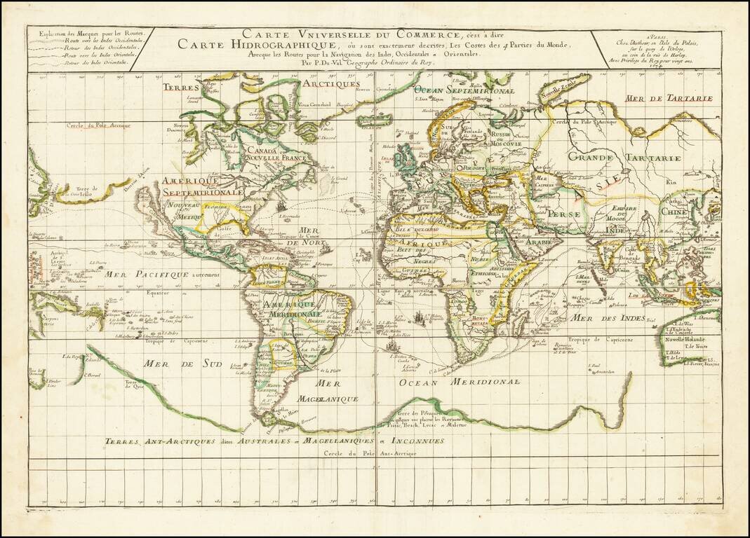
Illustrating the Major Commercial Sea Routes of the 17th Century First state of Pierre Du Val's scarce 17th Century map of the World, illustrating the most important world trade routes during the middle of the 17th Century. Du Val's map is...
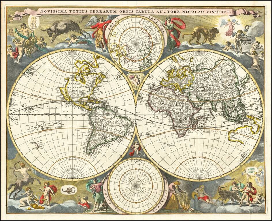
Gorgeous example of Nicholas Visscher's World map, which appeared in his Atlas Minor after 1679. The map is similar to Visscher's World map of 1659 (Shirley 406), only with the Straits of Anian being reduced to cover only 10 degrees. The surrounding...
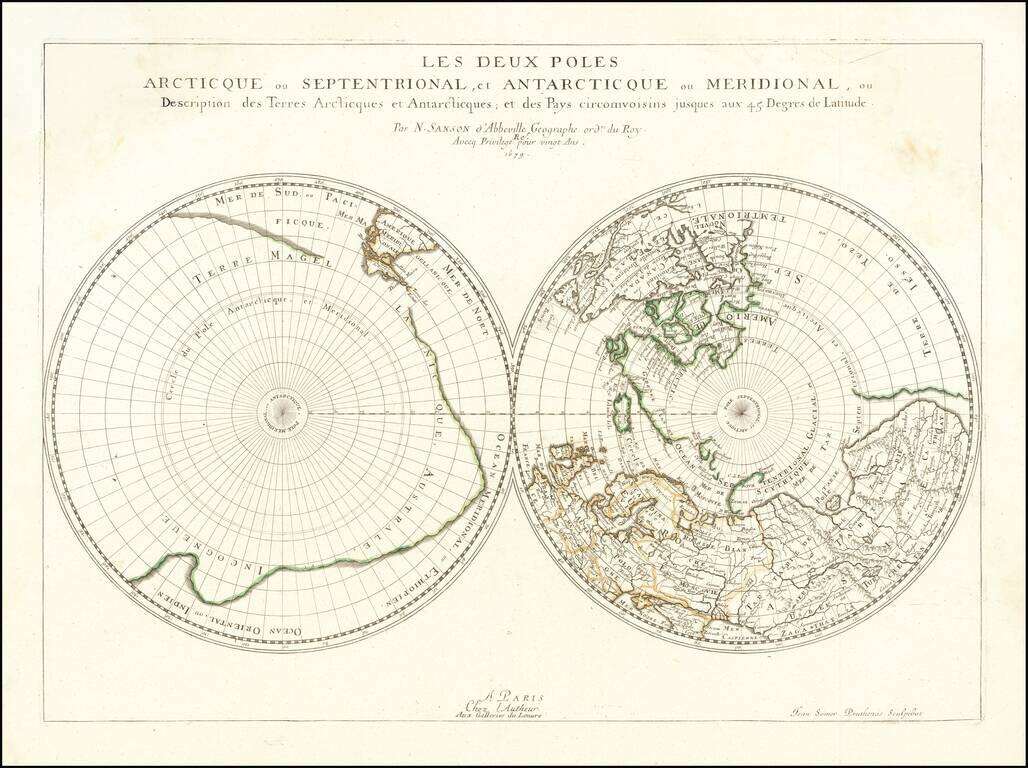
Sanson's Map of the Poles, the First Dual Polar Projection Fine old color example of this fascinating map of the Polar Regions, extending from the poles to 45 degrees latitude, first published by Sanson in 1657. Sanson is widely considered as the...
![[Wall Map of the World -- Totius Terrarum Orbis Geographica Descriptio . . . 1682]](/map/small/58871.jpg)
Unrecorded Wall Map of the World Based Upon Sanson's 6 Sheet Wall Map -- Not In Shirley! Rare separately published wall map of the World, published in Augsburg by Hans Georg Bodenehr in 1682. Originally issued in 60 small numbered sheets, the map was...
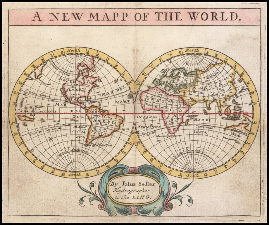
Rare miniature world map from Seller's Atlas Maritimus. The map shows California as and island, partial Australian Coastline, a fragment of New Zealand and many other early cartographic myths and evolving regions.
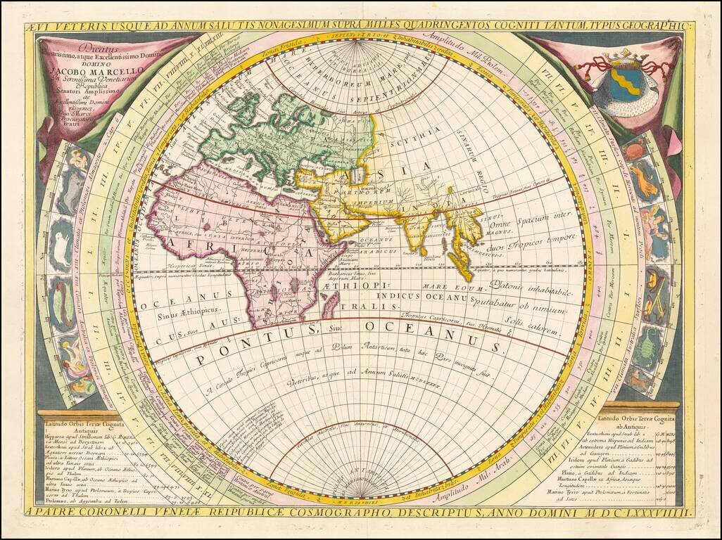
Fine example of Coronelli's map of the Old World, dedicated to Jacobo Marcello. Coronelli bases his map on classical geography, as known at the time of Ptolemy, Strabo and Mela, covering most of Africa and the Indian Ocean, but no Japan or China or NE...
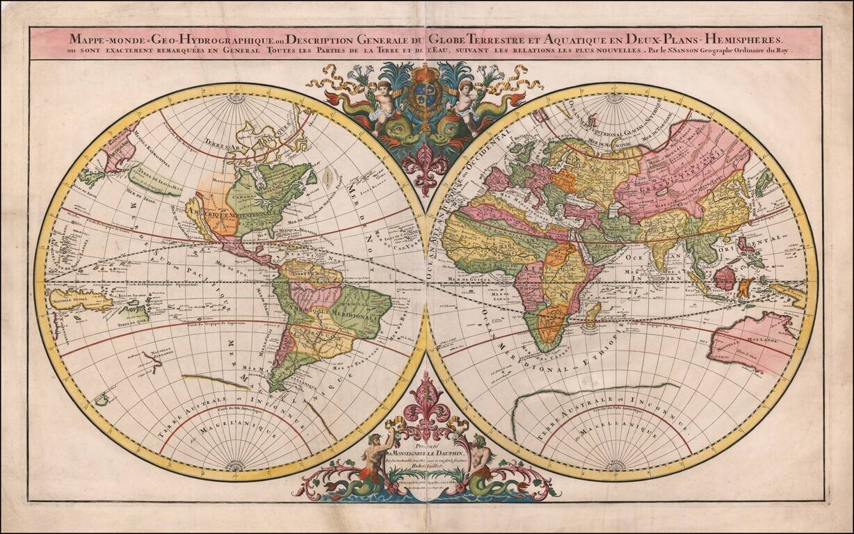
Striking Double Hemisphere World Map Elegant double hemisphere world map published by Alexis-Hubert Jaillot, featuring the latest discoveries and decorative embellishments. Particularly interesting geographic features include California as an island,...
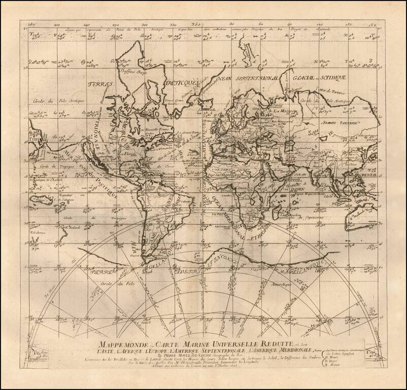
Rare world map by Pierre Moullart-Sanson, demonstrating a revolutionary means of finding longitude. This world map on Mercator's projection shows a means of recording the day's length according to the sun's Zodiacal position thus allowing (in theory)...
![Facies Una Hemisphaerii Terrestris [and] Facies Altera Hemisphaerii Terrestris](/map/small/68540.jpg)
An Unusual World Map with Signs of the Zodiac Scarce pair of hemisphere maps on two separate sheets, topped with the signs of the Zodiac, published by Johannes Zahn in Nuremberg. California is shown as an Island on the Briggs model, with a flat...
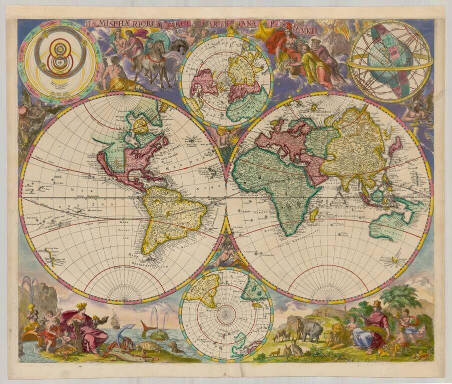
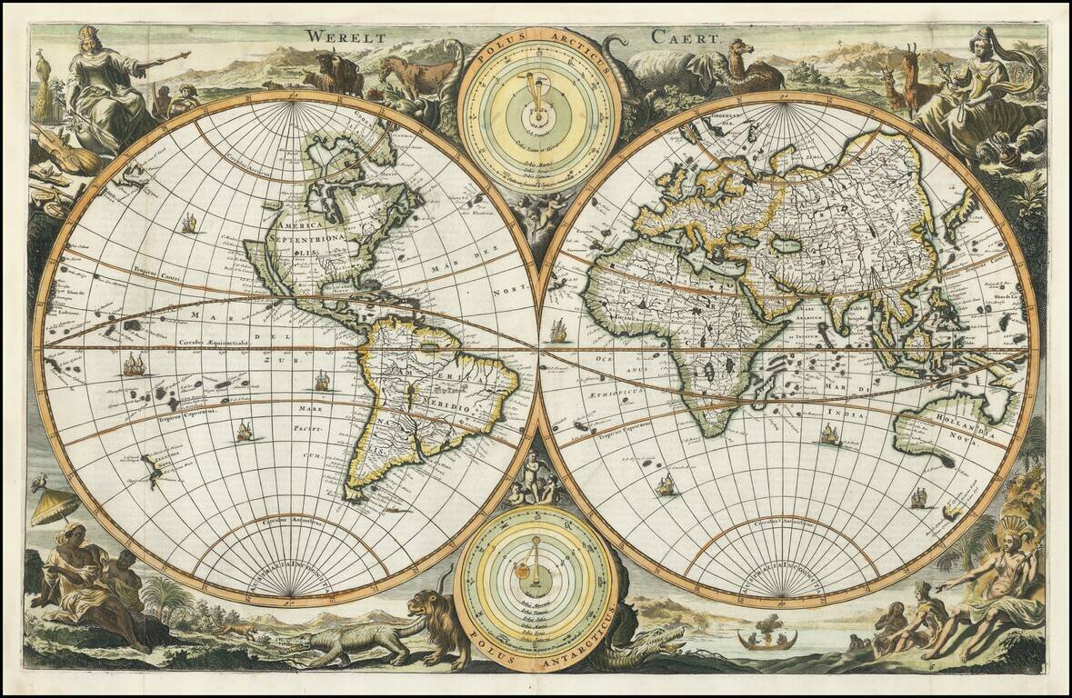
Rare separately published world map by Pieter Schenk II, published in Amsterdam. The map consists of twin hemispheres, embellished with two small polar hemispheres and two models of the solar system, with an elaborate set of vignettes surrounding the...
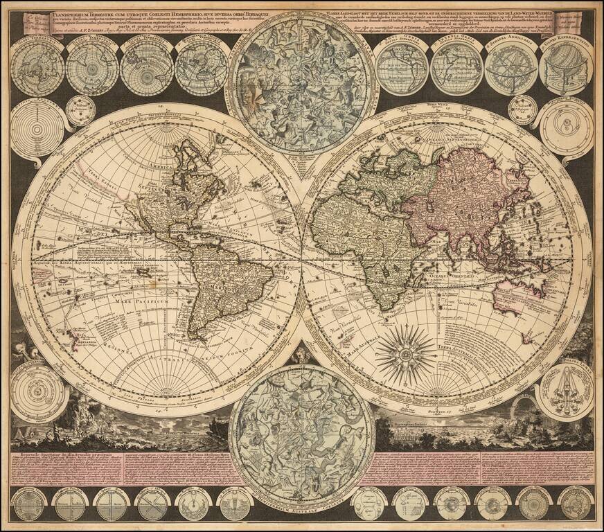
Visually Striking Double Hemisphere Map of the World Fine example of Adam Freidrich Zürner's complex and informative double hemisphere map of the world, artfully embellished with a multitude of decorative scenes and projections of celestial bodies....
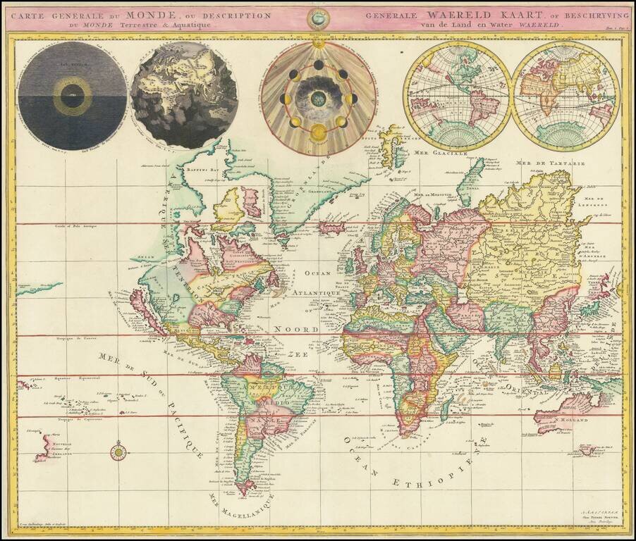
Striking example of Covens & Mortier's map of the World, showing California as an island. Five additional spheres across the top of the map illustrate night and day; the earth without water; the phases of the moon, and the eastern and western...
Very attractive double-hemisphere map with California depicted as an island. Decorative banner contains title. In the center of the banner there is a smaller sphere showing the North Pole. This map shows a number of place names along with the names of...
Decorative double hemisphere map of the World, showing California as an Island, with the Continents represented in the female form. The map is based upon Visscher's earlier Bible maps. There are a number of variants with subtle changes, issued in the...
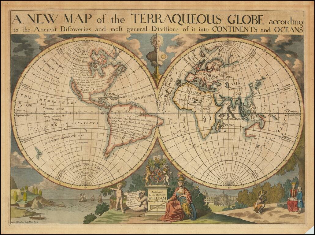
Decorative double hemisphere map of the World, dedicated to William, Duke of Glouchester. This map shows California as an Island, an incomplete New Holland attached to N. Guinea, partial New Zealand Coast line and no Southern Continent. Extensive...