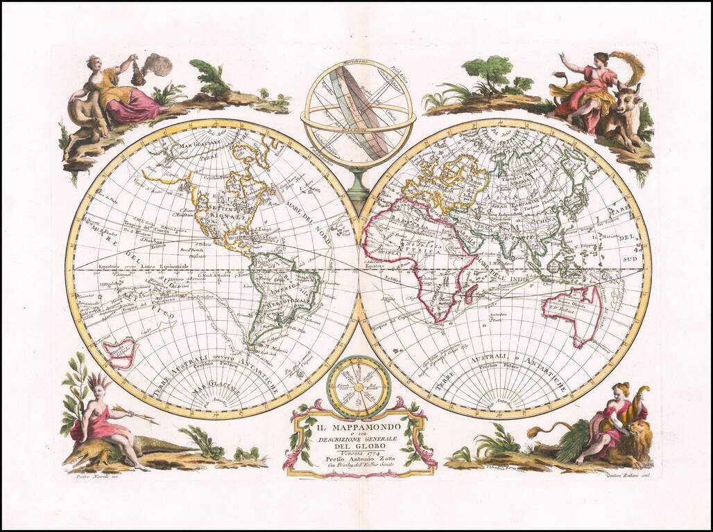
First edition of Antonio Zatta's decorative double hemisphere map of the World, published in Venice in 1774. Includes allegorical vignettes of the 4 continents, embellishing the outer corners. The map depicts the recent discoveries of Captain James...
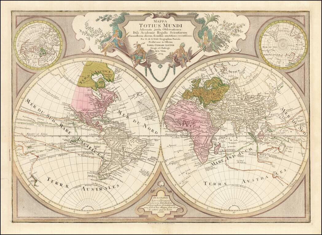
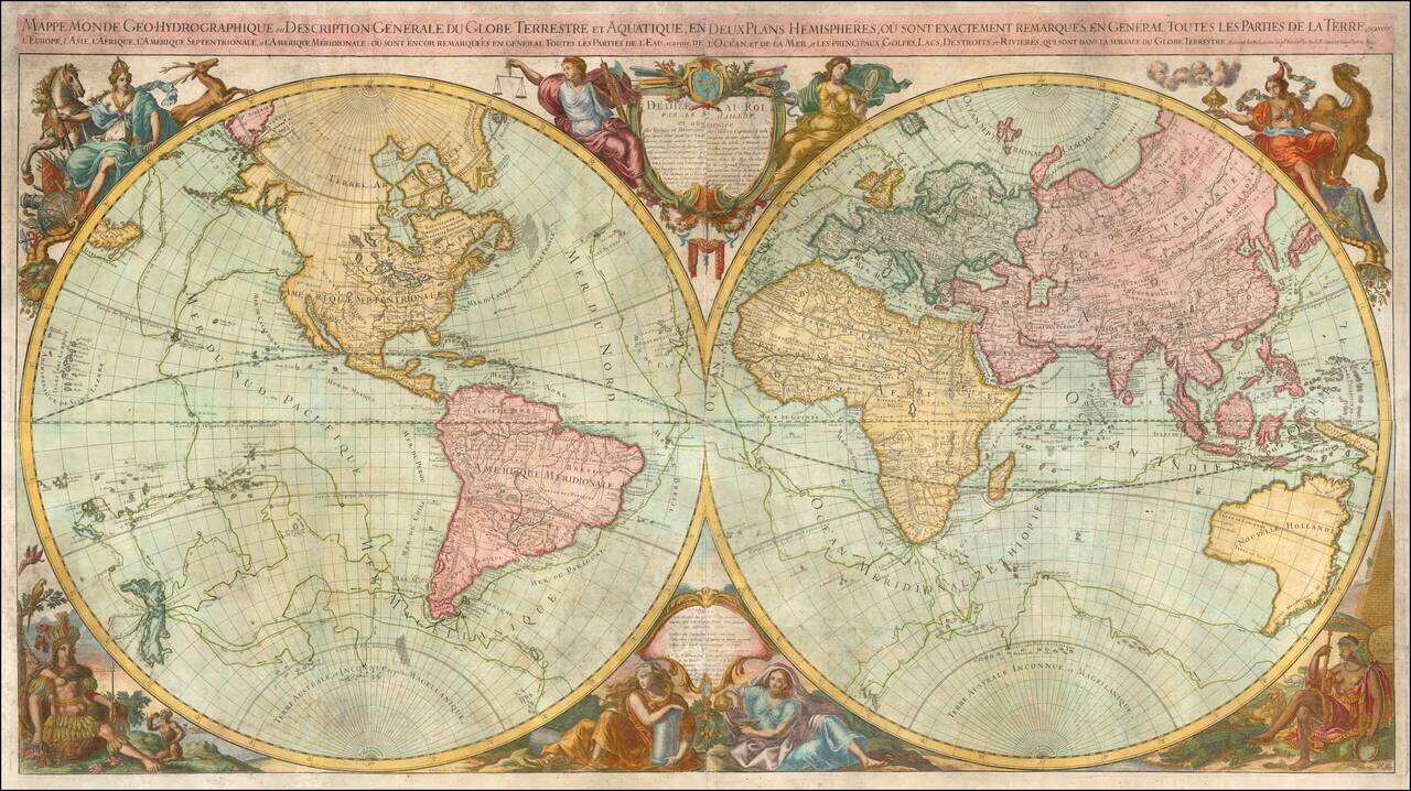
Decorative double hemisphere map of the World, published by TC Lotter in Augsburg. The map shows an number of early conjectural coastlines, including an incomplete coastline for Australia and New Guinea, New Zealand, the Northwest Coast of America,...
![[World - Hand Drawn Map]](/map/small/65170.jpg)
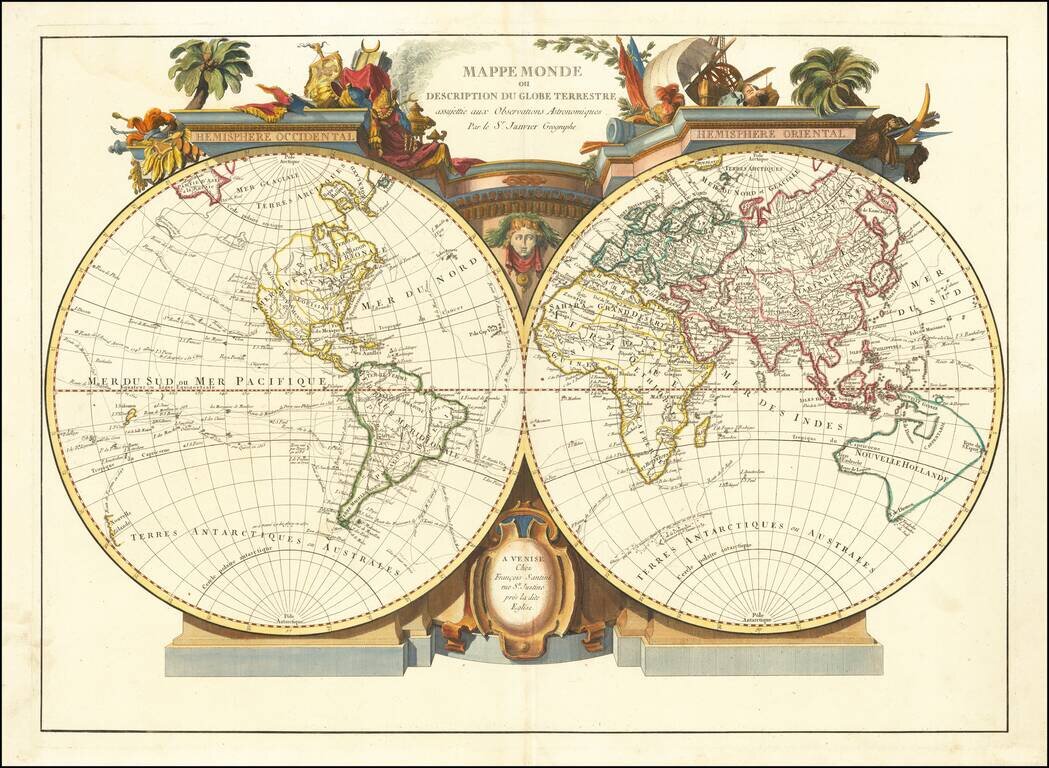
Interesting double hemisphere map of the world, drawn by an anonymous French hand. The map shows New Zealand after the discoveries of Captain James Cook, as is Australia. The Northwest Coast of America is also shown based upon Cook's discoveries,...
Striking large format decorative double hemisphere map of the World by Santini. The map shows the Sea of the West, an interesting conjectural projection of the NW Coast of America based upon the Russian Voyages in the mid-18th Century, but retaining a...
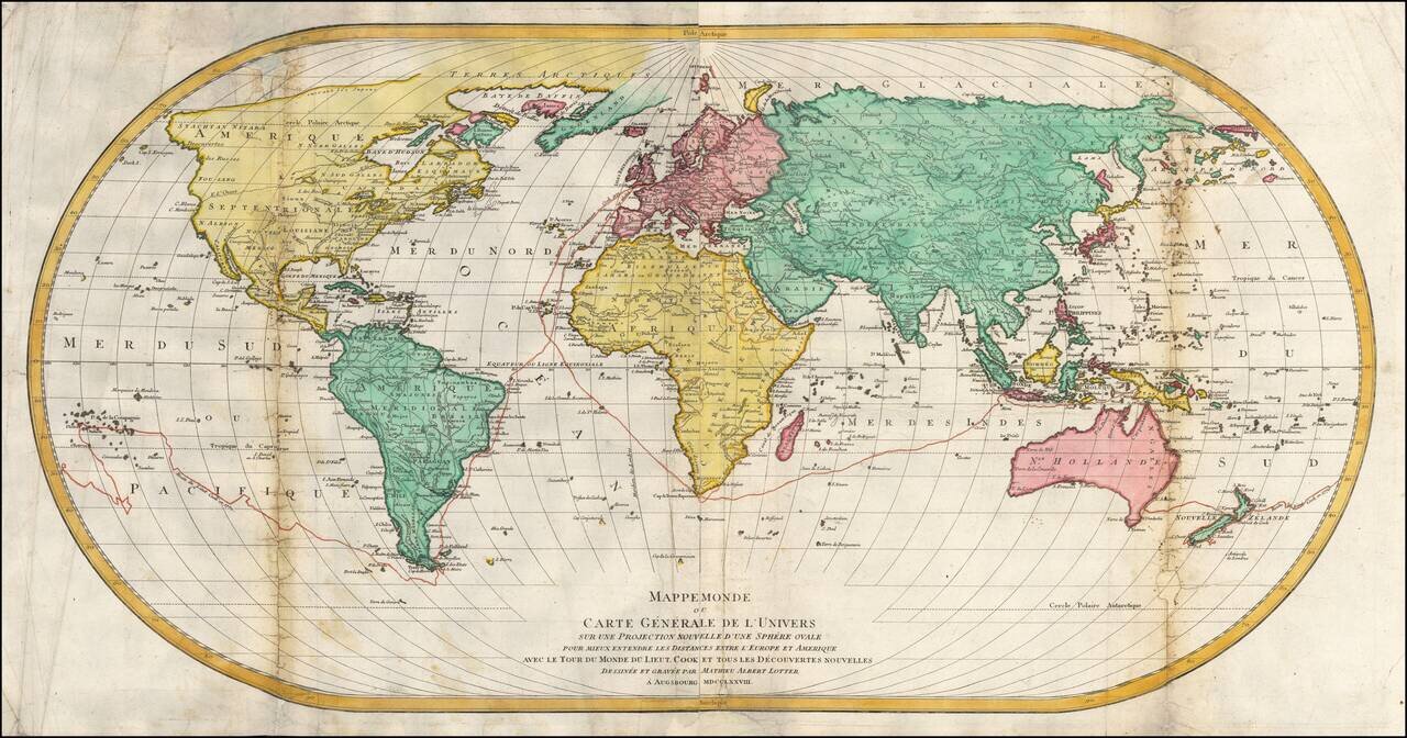
Tracking Captain James Cook's First Voyage -- 1768-1771 Rare first edition of this unusual large world map on an ovoid projection, published in Augsburg in 1778. The attractive and somewhat unusual ovoid projection is based on J.B.B. D'Anville's wall...
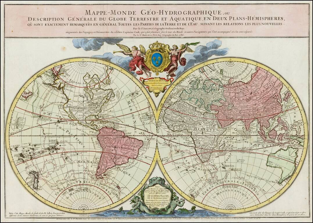
Rare, Double-Hemisphere Wall Map Exhibiting the Recent Discoveries of Captain James Cook Fine, large, double-hemisphere world map, originally published by Alexis-Hubert Jaillot and revised by Louis Brion de La Tour and Louis Charles Desnos, following...
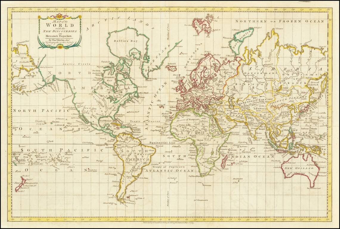
A World Map Immediately Following The Discovery of Hawaii Finely executed map of the World, focusing on the recent discoveries of Captain James Cook in his 3 Voyages of exploration which spanned the preceding decades. This map presents an interesting...
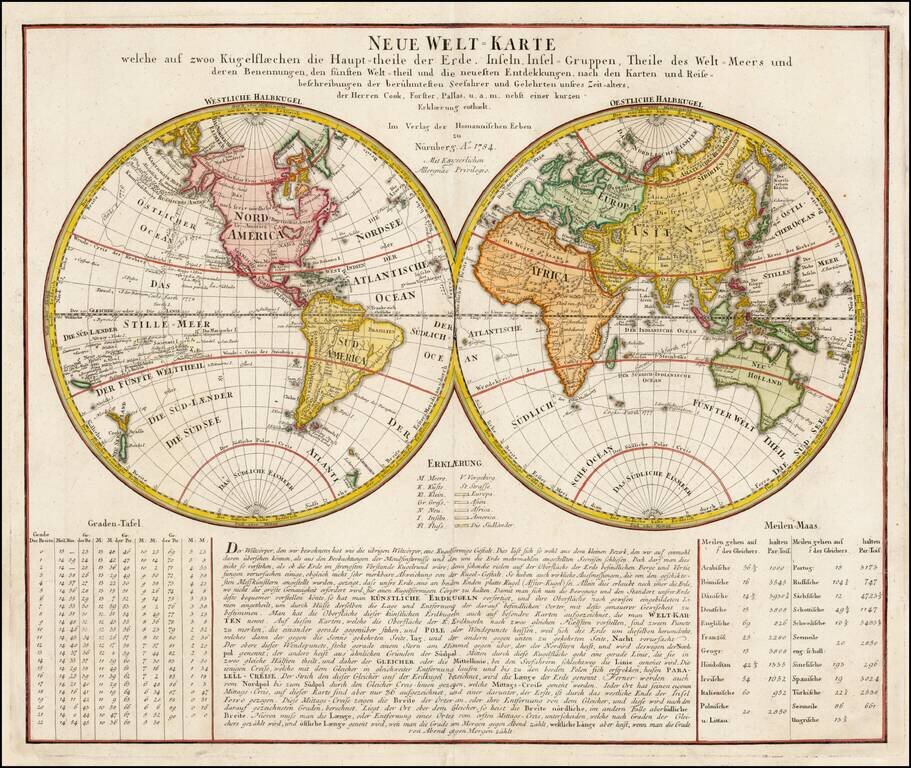
One of the First World Maps to Show Hawaii Double hemisphere map of the world, featuring extensive table and text below, published by Homann Heirs. An early World map to locate Hawaii, the map includes the tracks of Goree's voyage in 1780, Clerke's...
![Stereographic Projection [and] Orthographic Projection on the Plane of the Equator](/map/small/64905.jpg)
Interesting pair of hemispheric projections, illustrating two different styles for depicting the earth.
![[Japanese World Map] Kaisei Chikyu Bankoku sankai yochi zenzu setsu (Revised map of all countries on the globe/ Map of the world and its mountains and oceans)](/map/small/43034.jpg)
Fine example of the 1834 printing of Sekisui Nagakubo's landmark map of the World, based upon Matteo Ricci's map of the World, published in China. Sekisui Nagakubo's world map is one of the earliest world maps published in Japan. First issued circa...
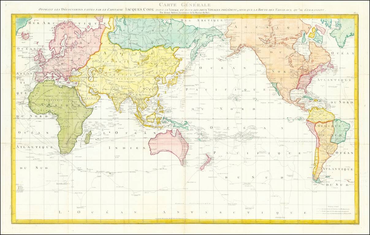
French Edition of the Official World Map Showcasing the Voyages of James Cook Striking French edition of a detailed world map including tracks of all three voyages of Captain James Cook, expeditions that redrew the map of the Pacific Ocean. The map...
Striking World Map with the Latest Discoveries and a Historical Cartographic Lineage Rare Louis Brion de la Tour edition of Jaillot's 1695 map of the world which has been significantly revised and updated to depict the routes of famous explorers in...
![Mappe-Monde Dressee pour l'Etude de la Geographie . . . 1778 [Bay of the West]](/map/small/61349.jpg)
Highly decorative double hemisphere map of the world, held aloft by two representations of Atlas. The Bay of the West is shown, as is a fascinating partial projection of Australia. The various lands off the coast of NW America are quite unusual.
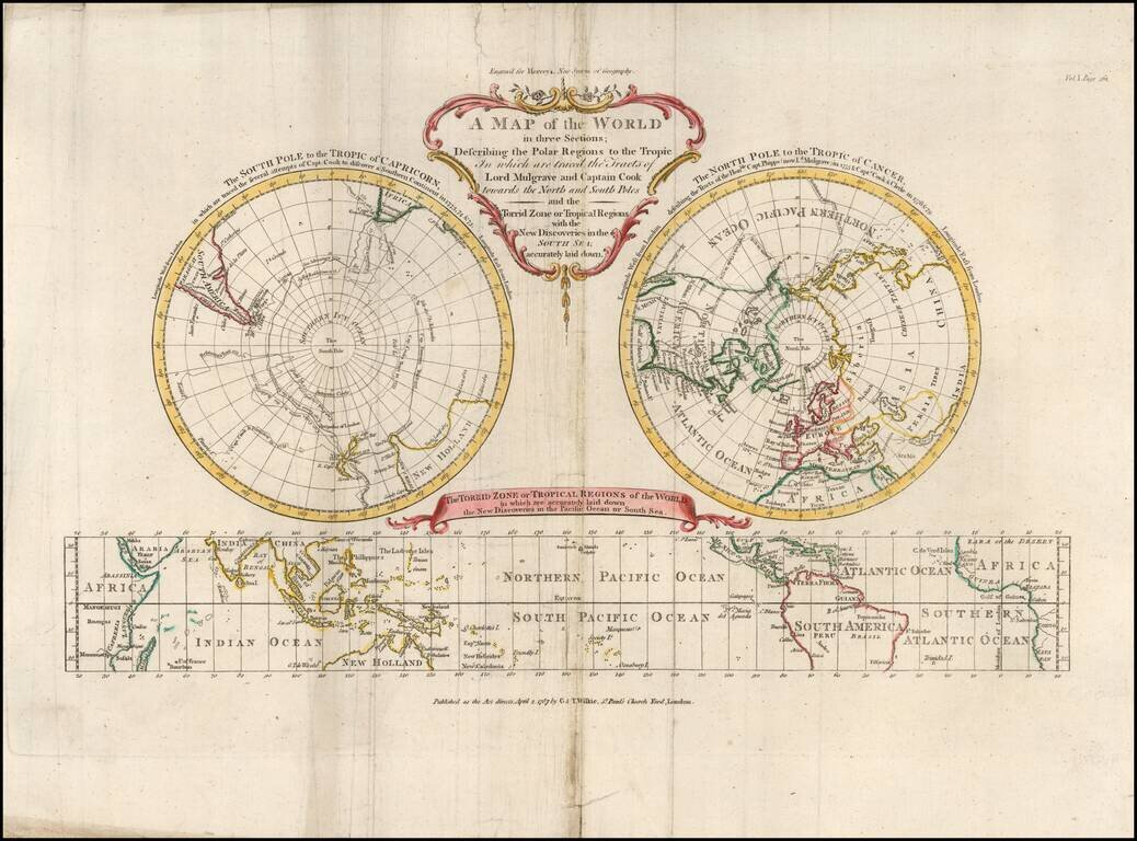
Three-Part World Map From Hervey's Geography, Showing the Voyages of Cook and Phipps to the Poles This tri-partite world map featured in Hervey's Geography. It shows the world divided in three: the North and South Pole on Polar projections, with a...
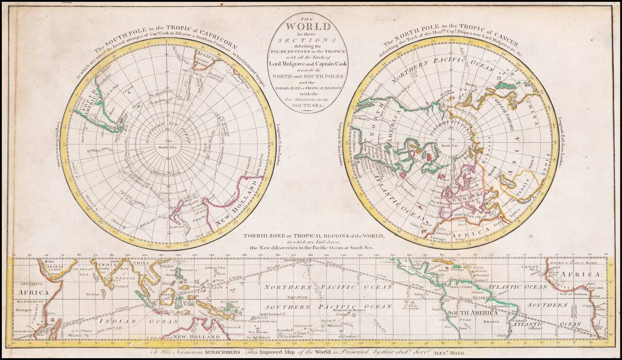
Three-Part World Map Showing the Voyages of Cook and Phipps to the Poles The map shows the world divided in three: the North and South Pole on Polar projections, with a cylindrical projection of the tropics at the bottom. The South Pole...
A number of celestial models and a rare double hemisphere world map.