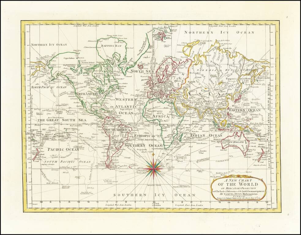
18th Century English Antique Map of the World Detailed map of the world, illustrating the tracks of the latest explorers to circumnavigate the world. The tracks shown includes the three Cook voyages, and those of Byron, Bougainville, Bouvet, etc....
![[Cyrillic -- Eastern & Western Hemispheres]](/map/small/32514.jpg)
Rare set of Eastern Hemisphere and Western Hemisphere maps, with place names in Cyrillic, likely published at the end of the 18th Century. The maps show Hawaii, but Tasmania (Van Diemens Land) is still attached to the mainland of Australia, which...
Interesting map of the world, published shortly after the third Voyage of Captain James Cook. Cook's route around the world on his third and final voyage is shown, including a note showing where Cook was killed by native Hawaiians in 1779.
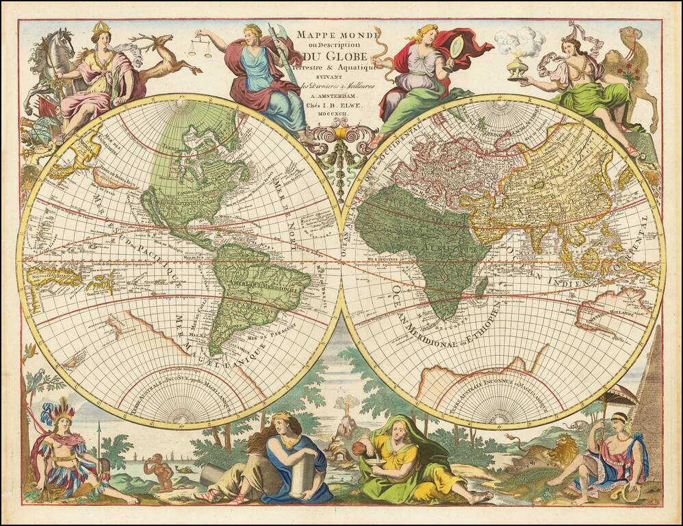
Hubert Jaillot's World Map Re-Issued At the End of the 18th Century Scarce Dutch decorative double hemisphere map of the World one of the most unique and decorative world maps of the period. By the end of the 17th Century, Paris was supplanting...
![Карта Шара Земнаго Солиненная по Астрономическимъ Наблю-денїямъ. Жанверомъ. [Globular Map of the Earth Compiled from Astronomical Observations. Janvier]](/map/small/65900.jpg)
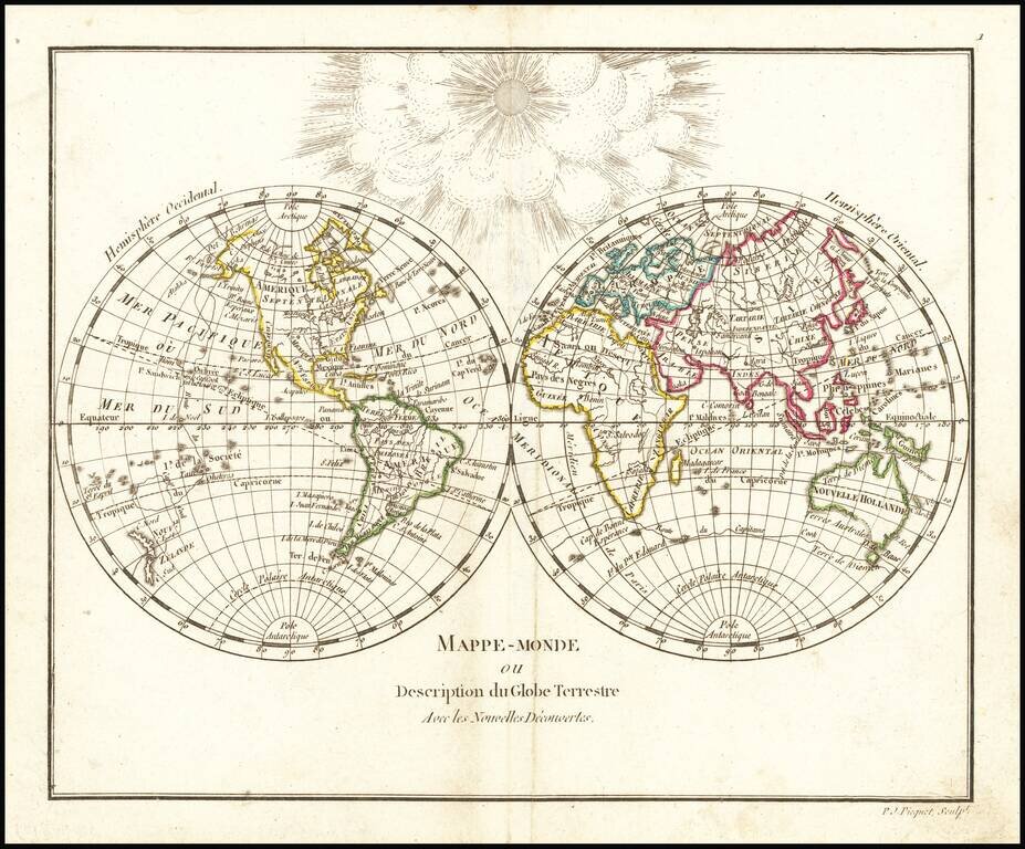
Rare 1793 Russian-language edition of Jean Janvier's double hemispheric world map "Mappe-Monde ou Description Du Globe Terrestre", originally published in 1762. The map appeared in the Saint Petersburg-published atlas: Новый атлас, или...
![[Manuscript World Map] Weltkarte oder Europa, Asia . . .](/map/small/68619.jpg)
Striking Eighteenth-Century German Student World Map Colorful double-hemisphere world map completed as a student project by Joan Baptista de Schmid in grade one. The geography on the map is eclectic and charming, the result of a young person’s...
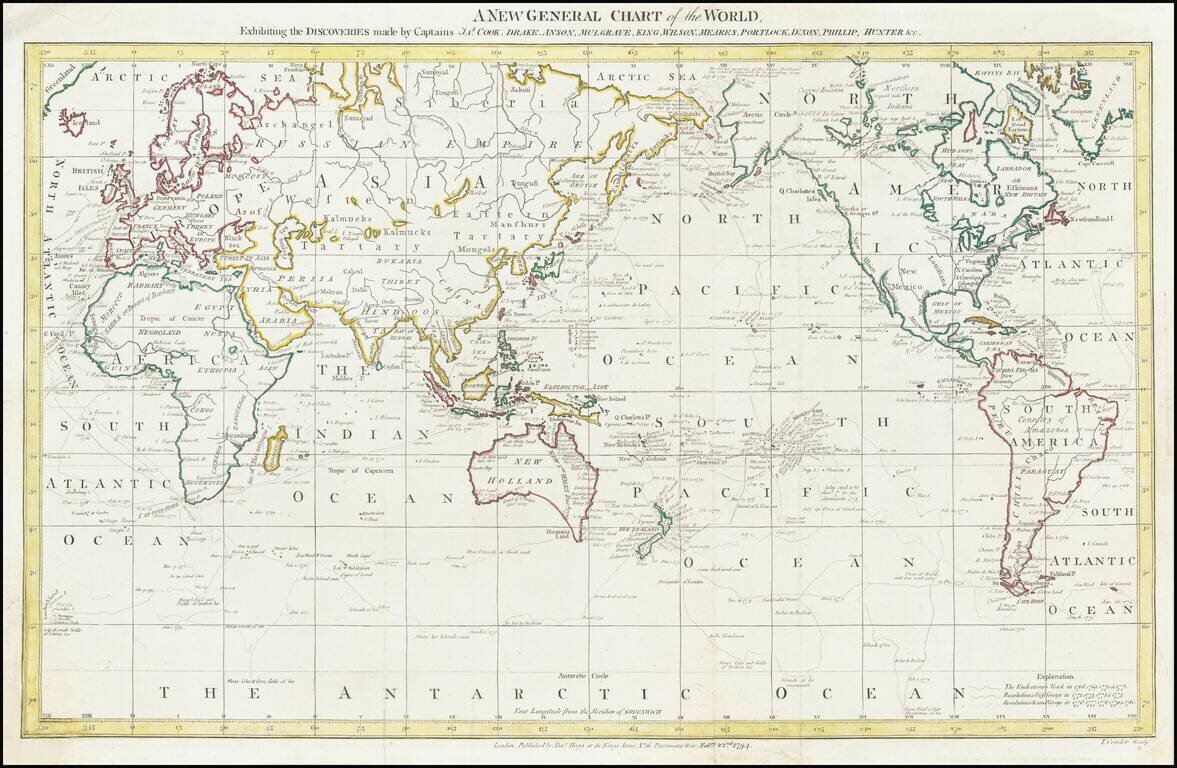
Fine World Map Showcasing the Voyages of James Cook Detailed world map including tracks of all three voyages of Captain James Cook, expeditions that redrew the map of the Pacific Ocean. The map centers on the South Seas, where Cook spent most of the...
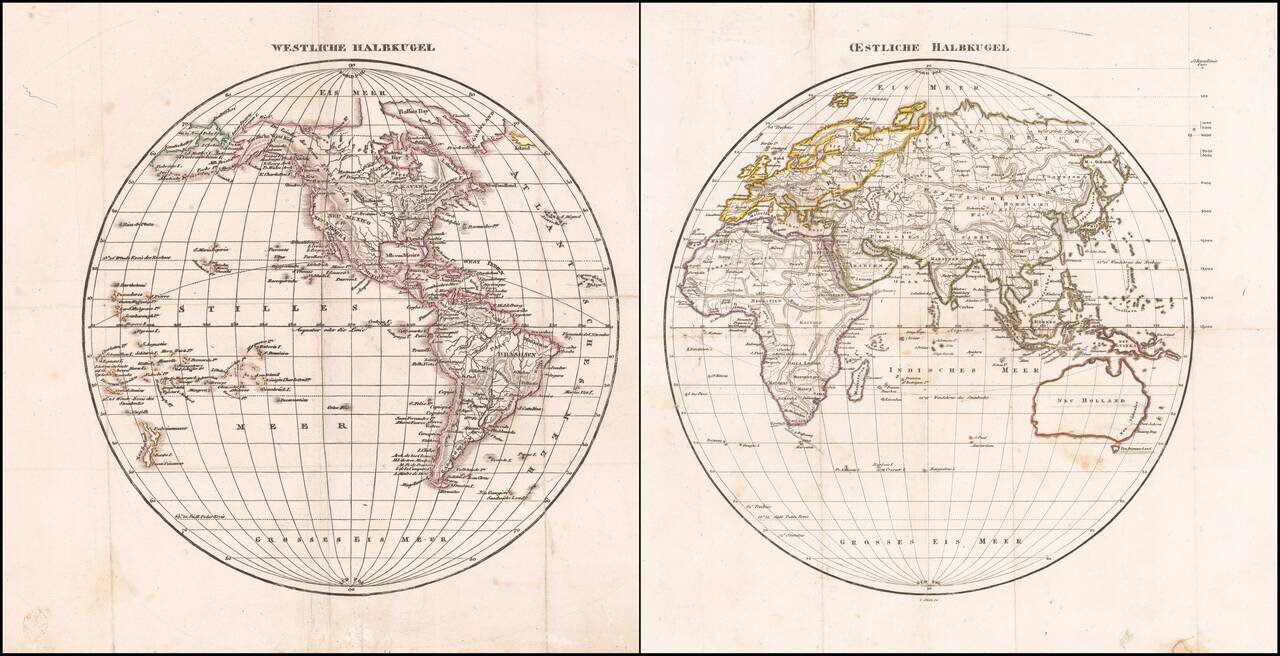
Antique Map of the Western Hemisphere and Eastern Hemisphere Scarce pair of hemispheric maps, issued in about 1800. Tasmania is separated from Australia and Washington D.C. is named, both of which suggest a date of about 1800.
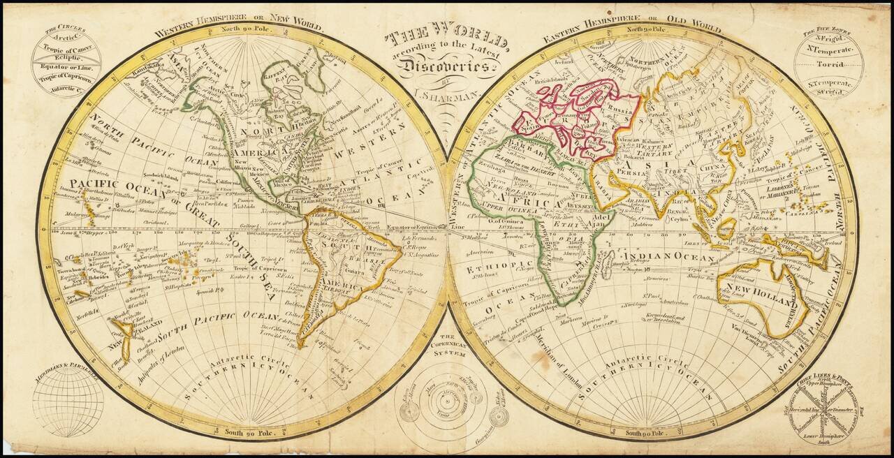
A Rare Dublin School Atlas Map Rare double hemisphere map of the world, published by Sharman in Dublin. The map shows the results of James Cook's three voyages. Of note, "Basses Straits" is shown, discovered by George Bass in 1798-99.
![Mappemonde a l'usage de l'Instr.on. par Guillaume Delisle et Philippe Buache Premiers Geographes et de l'Academie des Sciences. Revue e Augmentee des Nlles. Decouvertes par Dezauche . . . [Shows Cook's Discoveries in the Pacific]](/map/small/61573.jpg)
Printed in the 9th Year of the French Revolution Interesting double hemisphere map of the World, revised by Dezauche to include the discoveries of Captain James Cook on his three voyages of exploration in the Pacific. Among the most noteworthy...
![阿蘭陀 地球図 [Oranda Chikyuzu] [Image of the Earth]](/map/small/58461.jpg)
A Remarkable Japanese Manuscript Map of the World, Written in Russian, Copied from the Work of a Shipwrecked Japanese Sailor Striking double-hemisphere manuscript map of the world with toponyms written in Russian. The chart also includes the tracks of...
Including The Antipodes of the principal European Cities in the Southern Hemisphere Striking double hemisphere map of the world, revised to include the recent discoveries of Captain James Cook, La Perouse and Vancouver. The map includes tracts of...
Interesting map of the World, from Arrowsmith & Lewis's New & Elegant Atlas of the World. Shows the Sandwich Islands, an early post-Cook representation of New Zealand, Australia, and the northwest coast of America, etc. Australia without the...
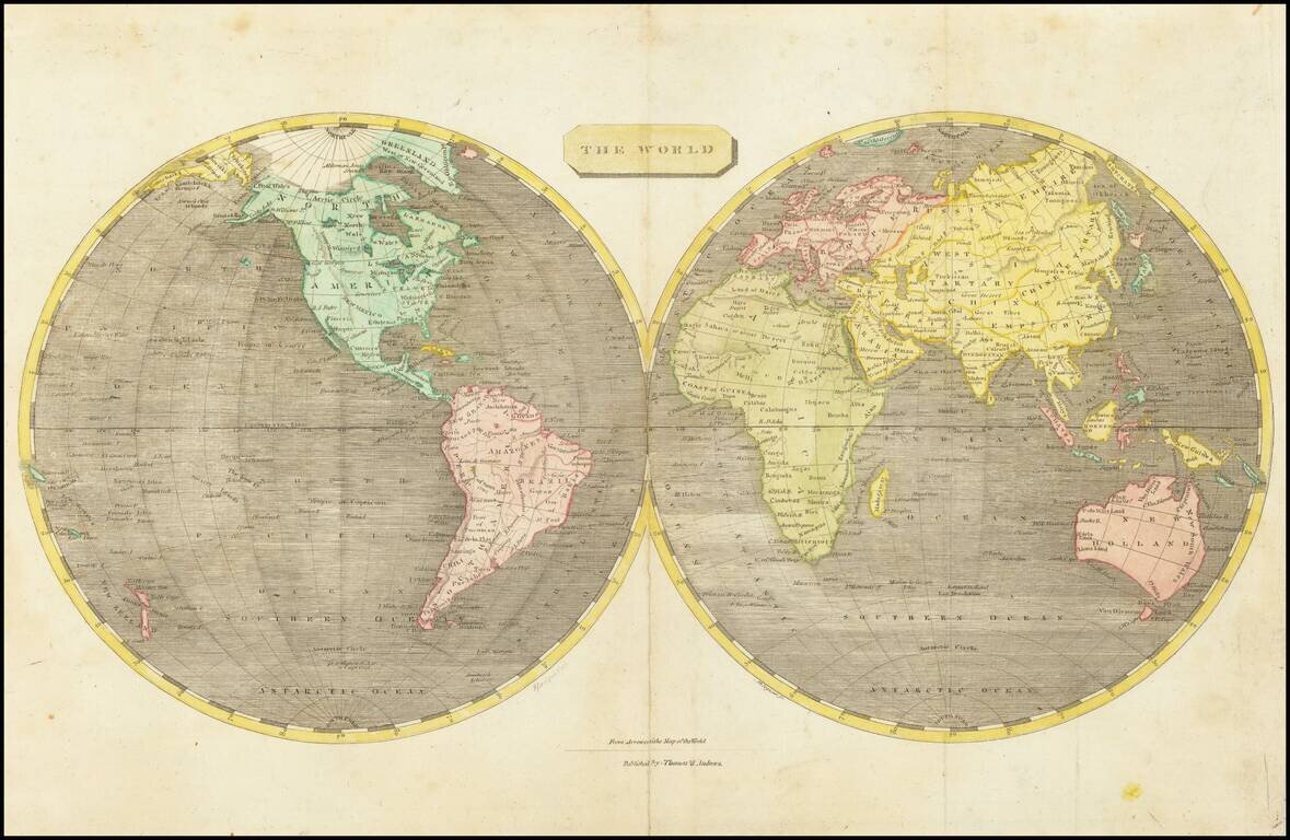
Nice double hemisphere map of the World, from Arrowsmith & Lewis's New & Elegant Atlas of the World. Shows the Sandwich Islands, an early post-Cook representation of New Zealand, Australia, and the northwest coast of America, etc. Curious shape...
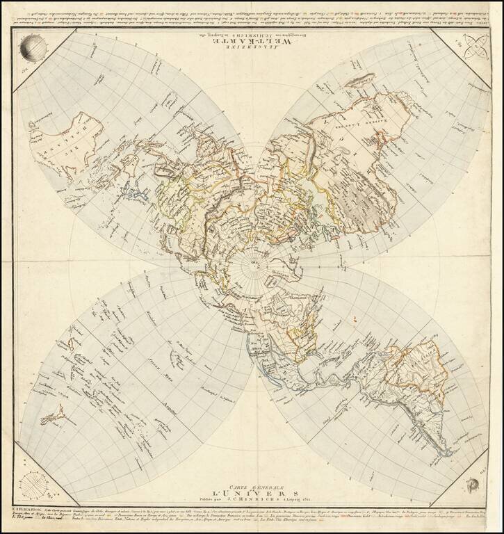
Striking, Innovative German World Map -- Projecting The Globe on A Flat Surface Distinctive world map published by German publisher Johann Conrad Hinrichs. It is an unusual azimuthal stereographic projection, which is then split into four lobes -- an...
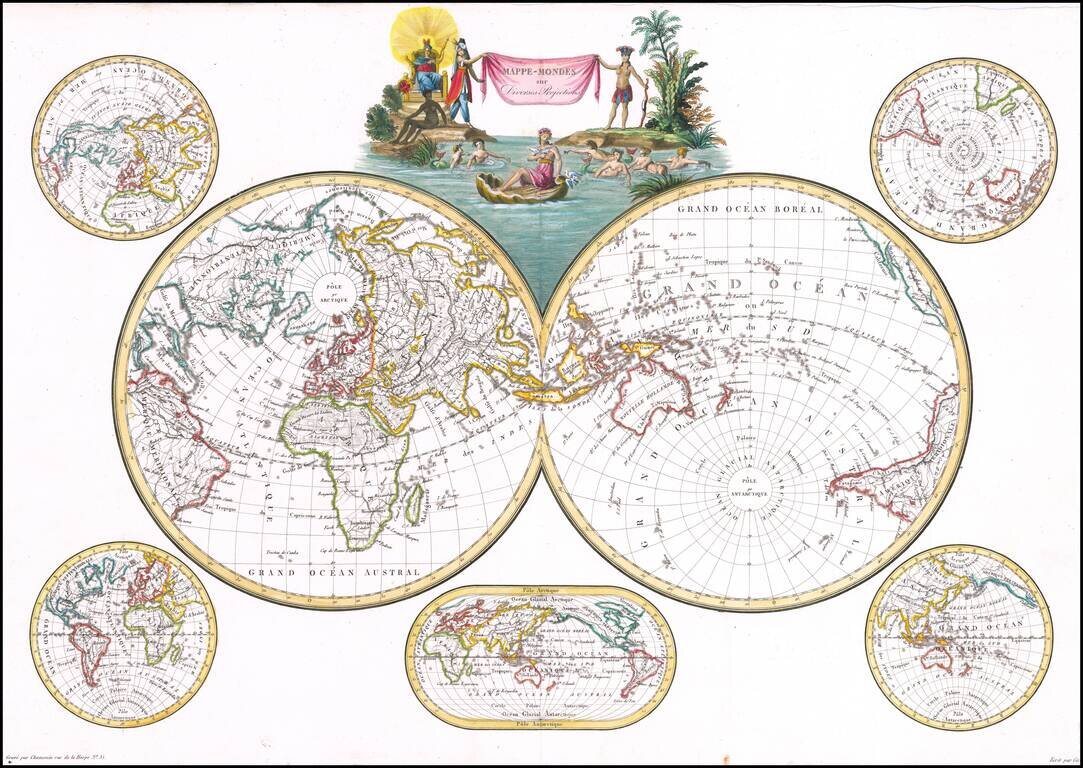
Decorative double hemisphere map of the World, published in Paris by Conrad Malte-Brun. The map includes a double hemisphere world map, with an additional smaller world maps centered on Australia and 4 other hemispheric projections. Malte-Brun's...